Salt River Bay National Historical Park and Ecological Preserve
Designation: National Historical Park and Ecological Preserve
Location: U.S. Virgin Islands
📘 Park Overview
Salt River Bay National Historical Park and Ecological Preserve uniquely documents the human and natural Caribbean world from the earliest indigenous settlements in the central Caribbean to their clash with seven different colonial European powers to the present day.
🌤 Weather Information
Welcome to the tropics!
🚗 Directions
There are several air carriers to St Croix arriving at the Henry E. Rohlesen Airport. The park is five miles from Christiansted National Historic Site and can be reached by car via Rt. 75 from Christiansted, connecting to Route 80. Cars may be rented at the airport and various other island locations. Ask your lodging hosts for information about guided land tours.
Images
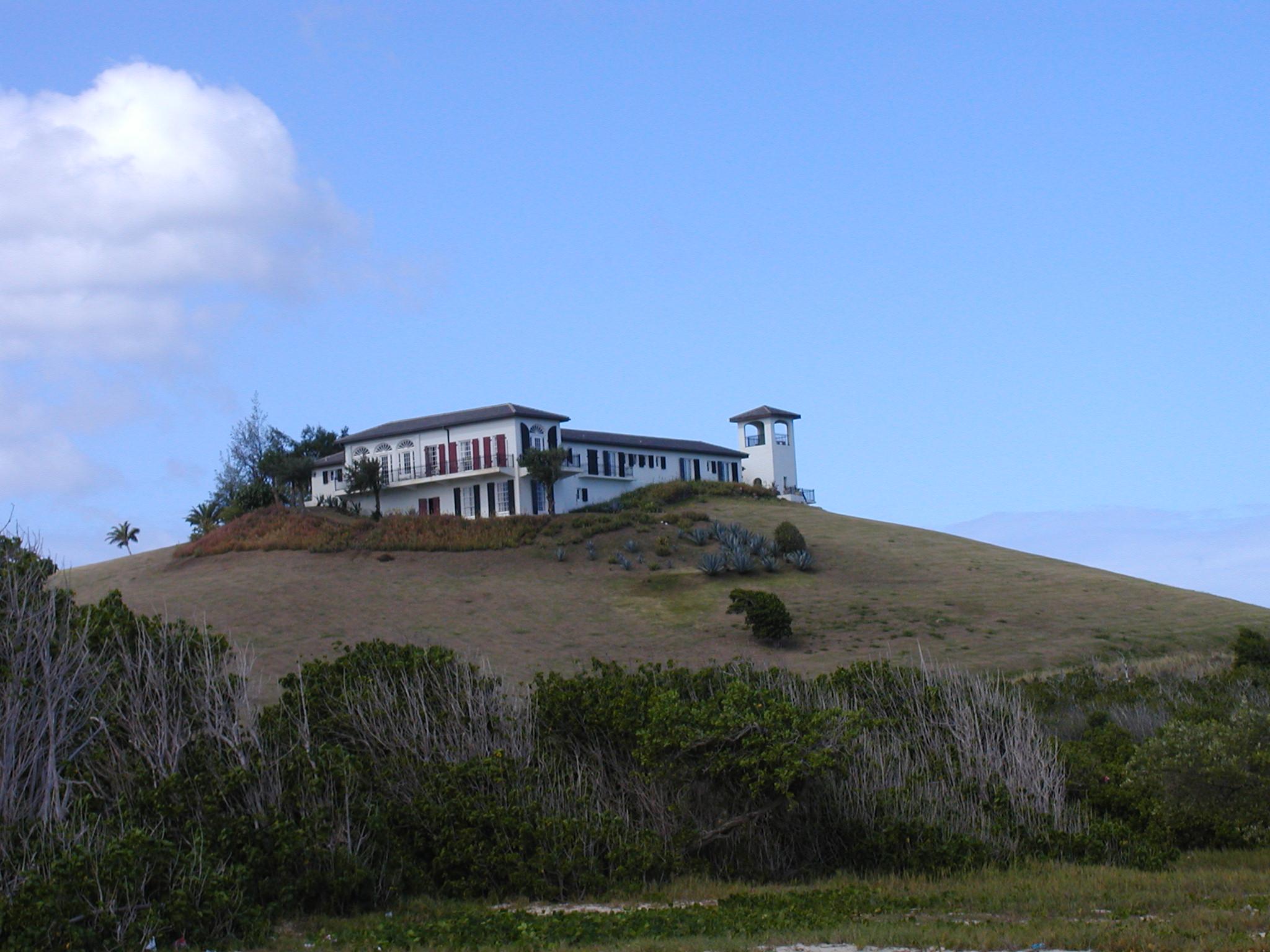
View of the Salt River Bay Visitor Contact Station from below.
Credit: NPS Photo
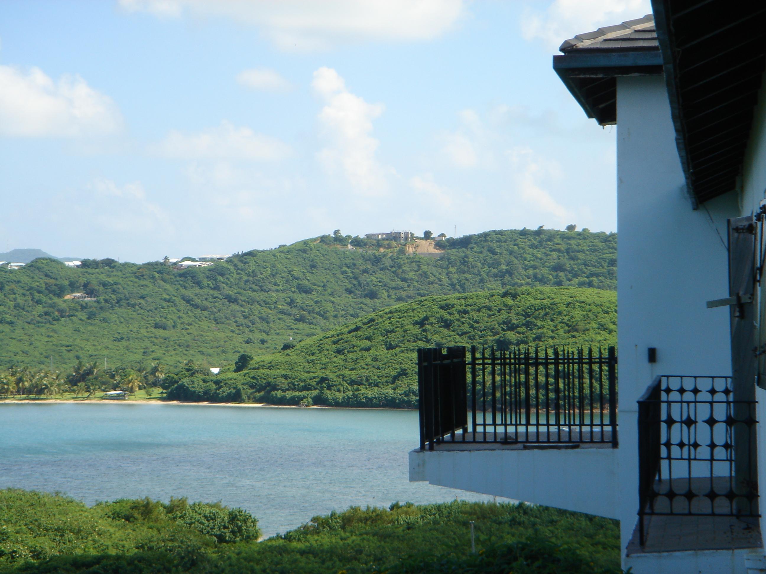
Many visitors visit the Visitor Contact Station and view Salt River Bay from this scenic vista.
Credit: NPS Photo
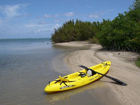
Kayaking is a great way to see our mangroves and beaches!
Credit: S. Corsaut, Digital Island.
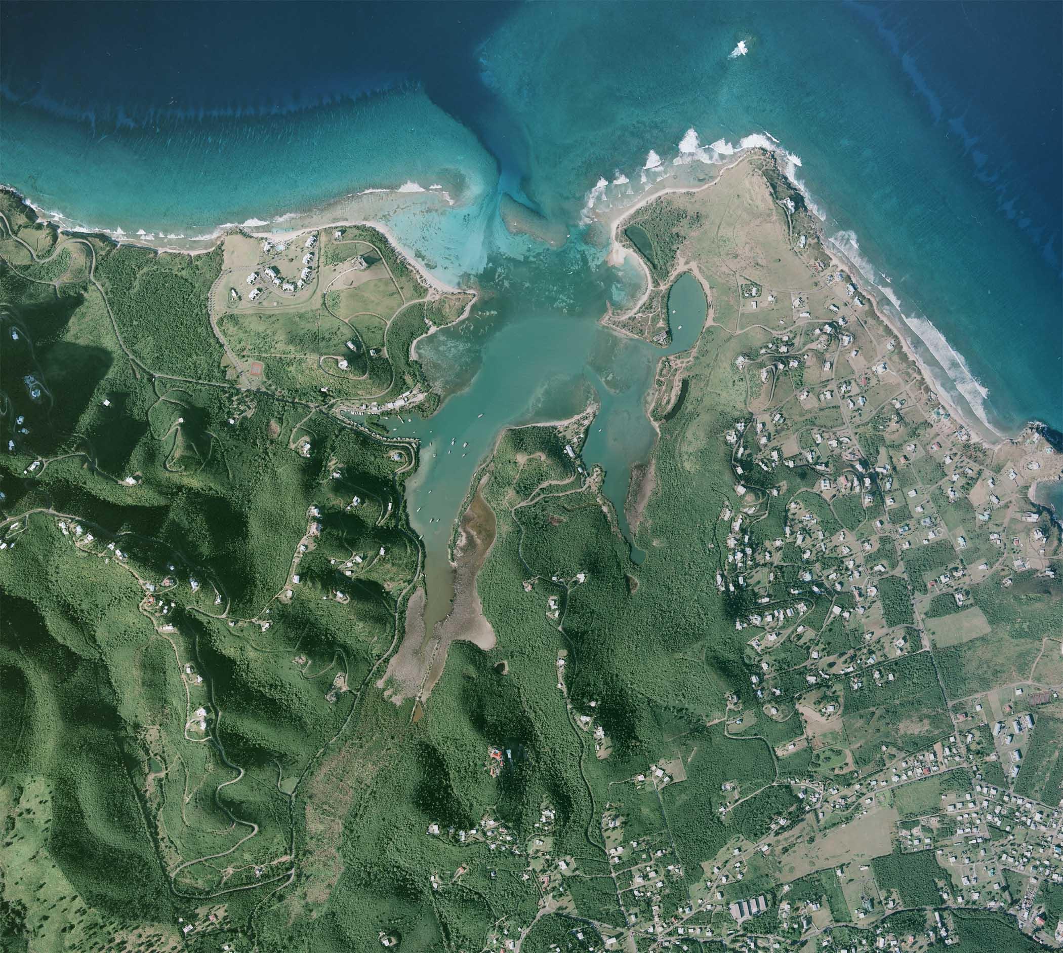
An aerial view of the Salt River Bay area.
Credit: NPS Photo
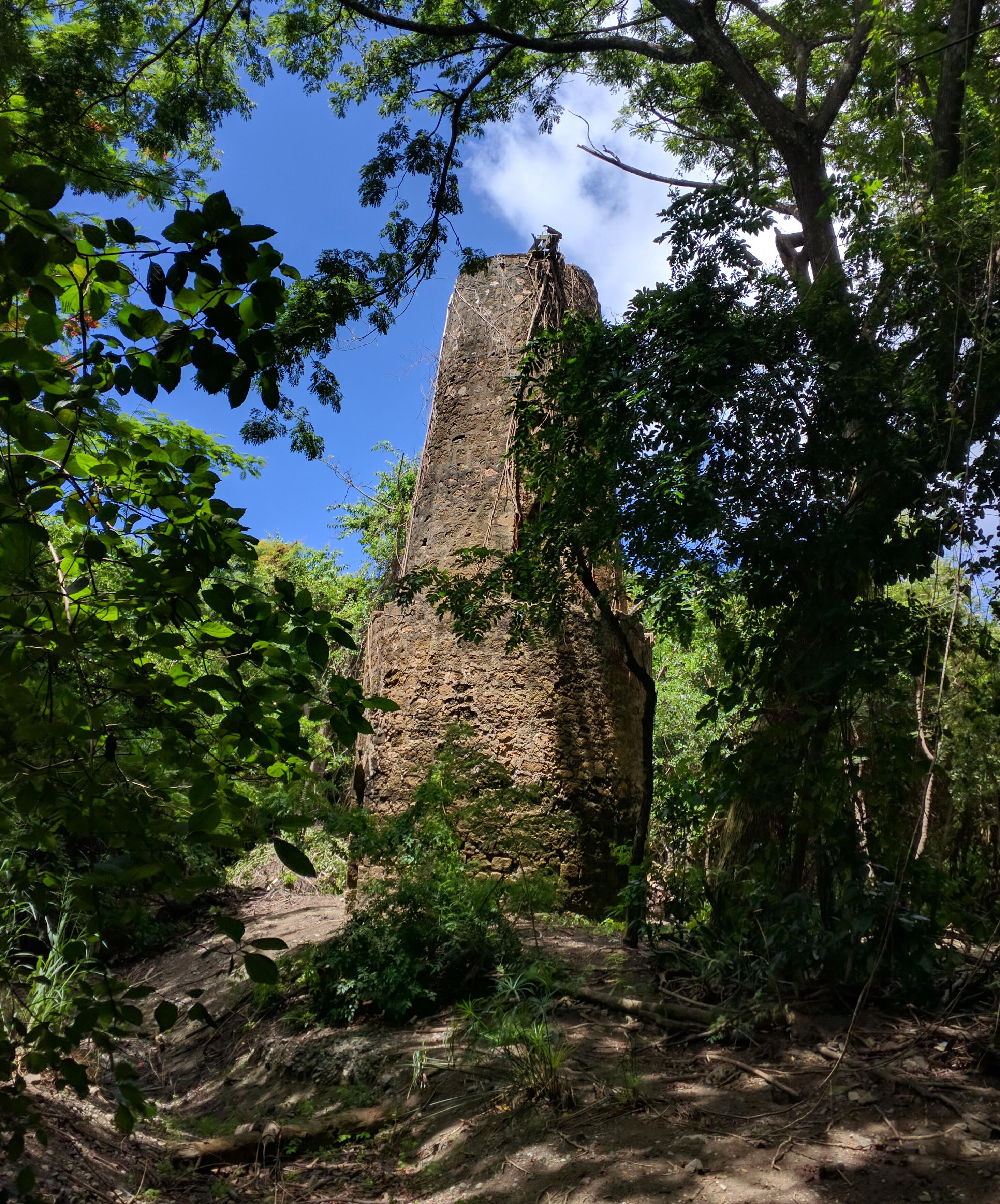
This brick and coral block masonry tower, built in the 1790s, used the power of wind to move water from Salt River to neighboring plantation estates.
Credit: NPS photo.
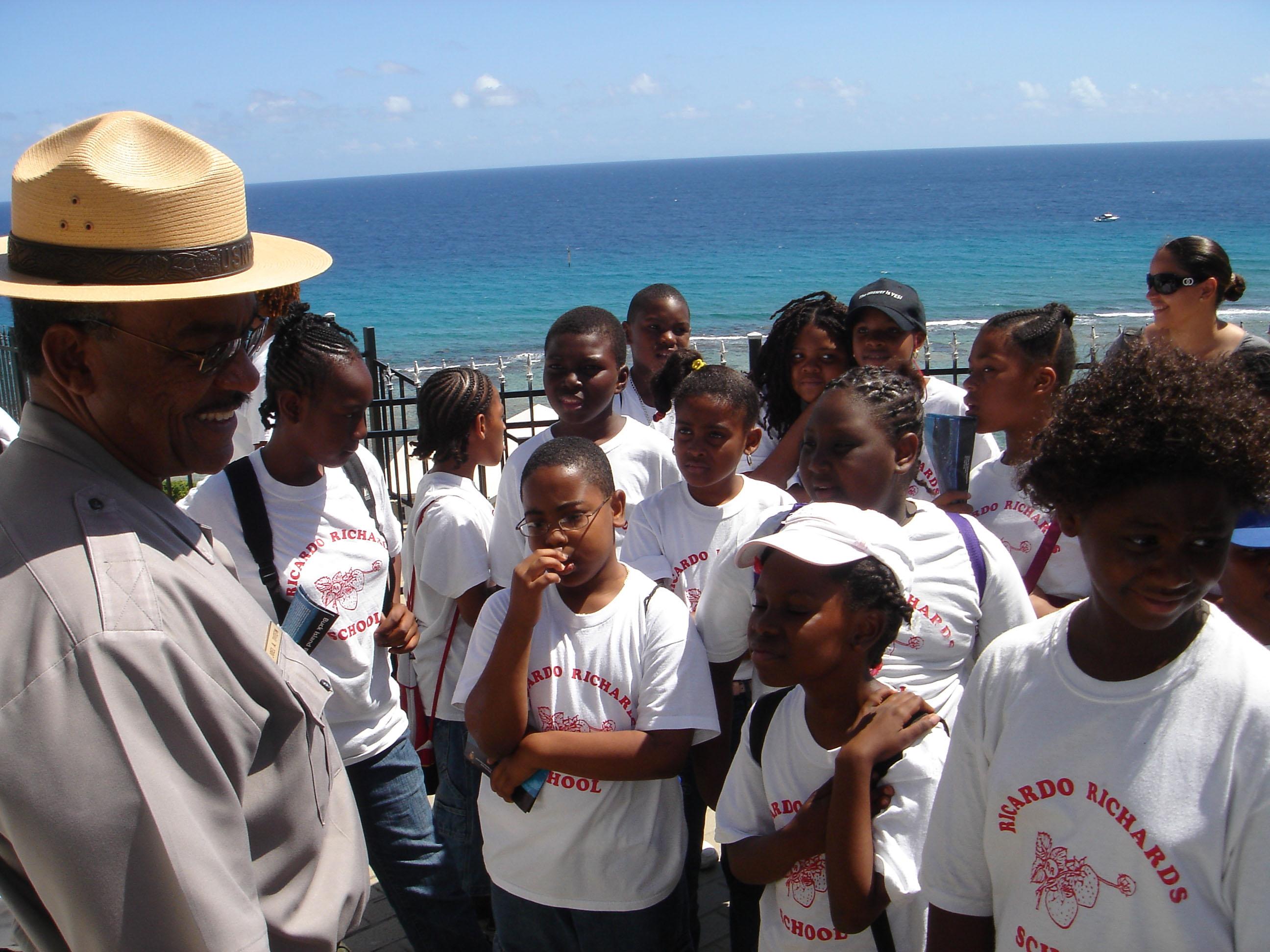
Students and summer campers come to Salt River to learn about our island's nature and history.
Credit: NPS
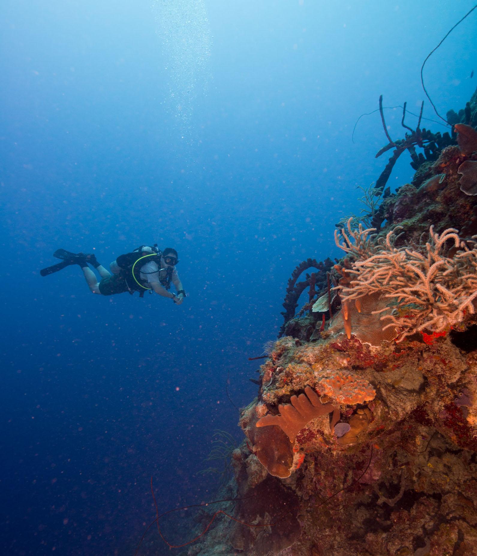
SCUBA divers from around the world come to dive the famous canyon walls at Salt River.
Credit: NPS
Activities
Topics
Operating Hours
Entrance Fees
No entrance fees listed.
Entrance Passes
No entrance passes listed.
3-Day Weather Forecast
Thursday, Apr 2

Partly Cloudy
High: 83.1°F | Low: 76.5°F
Humidity: 81%
Wind: 15.7 mph
Rain Chance: 0%
UV Index: 2.9
Sunrise: 06:13 AM
Sunset: 06:33 PM
Moon: Full Moon (100%)
Visibility: 6 mi
Dew Point: 74.9°F
Cloud Cover: 0%
Pressure: N/A mb
Air Quality (PM2.5): N/A
Ozone: N/A
EPA Index: N/A
Friday, Apr 3
Partly Cloudy
High: 78.6°F | Low: 76.1°F
Humidity: 79%
Wind: 16.6 mph
Rain Chance: 0%
UV Index: 2.9
Sunrise: 06:12 AM
Sunset: 06:33 PM
Moon: Waning Gibbous (99%)
Visibility: 6 mi
Dew Point: 73.6°F
Cloud Cover: 0%
Pressure: N/A mb
Air Quality (PM2.5): N/A
Ozone: N/A
EPA Index: N/A
Saturday, Apr 4

Sunny
High: 83.3°F | Low: 77.7°F
Humidity: 79%
Wind: 19 mph
Rain Chance: 0%
UV Index: 2.7
Sunrise: 06:11 AM
Sunset: 06:33 PM
Moon: Waning Gibbous (96%)
Visibility: 6 mi
Dew Point: 74.9°F
Cloud Cover: 0%
Pressure: N/A mb
Air Quality (PM2.5): N/A
Ozone: N/A
EPA Index: N/A
Weather Alerts (4)
High Surf Advisory issued April 2 at 3:30AM AST until April 2 at 6:00PM AST by NWS San Juan PR
Effective: Apr 2, 2026 3:30am
Expires: Apr 2, 2026 6:00pm
* WHAT...For the High Surf Advisory, large breaking waves of 10 to
12 feet, occasionally higher. For the High Rip Current Risk,
life- threatening rip current.
* WHERE...For the High Surf Advisory, the most vulnerable areas
for high surf and beach erosion include Pinones along Road 187,
Parcelas Suarez, Villas del Mar, and Villa Cristiana in Loiza;
Fortuna in Luquillo; Pueblo and Tamarindo in Aguadilla; Bario
Obrero, Pueblo and Jareaito in Arecibo; Las Boca in Barceloneta;
Machuca in Manati; Puerto Nuevo in Vega Baja; Ocean Park in San
Juan; and Barrio Espinal in Aguada. For the High Rip Current
Risk, exposed beaches, mainly along the north- and east coasts.
* WHEN...For the High Surf Advisory, remains until 6 PM AST this
evening. For the High Rip Current Risk, through Sunday
afternoon.
* IMPACTS...For the High Surf Advisory, high waves that can wash
over jetties and sweep people and pets onto jagged rocks. Rough
surf may also knock you down. Large breaking waves will result
in localized beach/dune structure erosion and dangerous swimming
conditions. For the High Rip Current Risk, rip currents can
sweep even the best swimmers away from shore into deeper water,
where it becomes difficult to return to safety.
Rip Current Statement issued April 2 at 3:30AM AST until April 5 at 6:00PM AST by NWS San Juan PR
Effective: Apr 2, 2026 3:30am
Expires: Apr 2, 2026 6:00pm
* WHAT...For the High Surf Advisory, large breaking waves of 10 to
12 feet, occasionally higher. For the High Rip Current Risk,
life- threatening rip current.
* WHERE...For the High Surf Advisory, the most vulnerable areas
for high surf and beach erosion include Pinones along Road 187,
Parcelas Suarez, Villas del Mar, and Villa Cristiana in Loiza;
Fortuna in Luquillo; Pueblo and Tamarindo in Aguadilla; Bario
Obrero, Pueblo and Jareaito in Arecibo; Las Boca in Barceloneta;
Machuca in Manati; Puerto Nuevo in Vega Baja; Ocean Park in San
Juan; and Barrio Espinal in Aguada. For the High Rip Current
Risk, exposed beaches, mainly along the north- and east coasts.
* WHEN...For the High Surf Advisory, remains until 6 PM AST this
evening. For the High Rip Current Risk, through Sunday
afternoon.
* IMPACTS...For the High Surf Advisory, high waves that can wash
over jetties and sweep people and pets onto jagged rocks. Rough
surf may also knock you down. Large breaking waves will result
in localized beach/dune structure erosion and dangerous swimming
conditions. For the High Rip Current Risk, rip currents can
sweep even the best swimmers away from shore into deeper water,
where it becomes difficult to return to safety.
High Surf Advisory issued April 2 at 10:33AM AST until April 2 at 6:00PM AST by NWS San Juan PR
Effective: Apr 2, 2026 10:33am
Expires: Apr 2, 2026 7:00pm
* WHAT...For the High Surf Advisory, large breaking waves of 10 to
12 feet, occasionally higher. For the High Rip Current Risk,
life-threatening rip currents.
* WHERE... For the High Surf Advisory, the most vulnerable areas
for high surf and beach erosion include Pinones along Road 187,
Parcelas Suarez, Villas del Mar, and Villa Christiana in Loiza;
Fortuna in Luquillo; Pueblo and Tamarindo in Aguadilla; Barrio
Obrero, Pueblo and Jareaito in Arecibo; Las Boca in Barceloneta;
Machuca in Manati; Puerto Nuevo in Vega Baja; Ocean Park in San
Juan; and Barrio Espinal in Aguada. For the High Rip Current
Risk exposed beaches, mainly along the north- and east coasts.
* WHEN...For the High Surf Advisory, until 6 PM AST this evening.
For the High Rip Current Risk, through Sunday afternoon
* IMPACTS...For the High Surf Advisory, high waves that can wash
over jetties and sweep people and pets onto jagged rocks. Rough
surf may also knock you down. Large breaking waves will result
in localized beach/dune structure erosion and dangerous swimming
conditions. For the High Rip Current Risk rip currents can
sweep even the best swimmers away from shore into deeper water,
where it becomes difficult to return to safety.
Rip Current Statement issued April 2 at 10:33AM AST until April 5 at 6:00PM AST by NWS San Juan PR
Effective: Apr 2, 2026 10:33am
Expires: Apr 2, 2026 7:00pm
* WHAT...For the High Surf Advisory, large breaking waves of 10 to
12 feet, occasionally higher. For the High Rip Current Risk,
life-threatening rip currents.
* WHERE... For the High Surf Advisory, the most vulnerable areas
for high surf and beach erosion include Pinones along Road 187,
Parcelas Suarez, Villas del Mar, and Villa Christiana in Loiza;
Fortuna in Luquillo; Pueblo and Tamarindo in Aguadilla; Barrio
Obrero, Pueblo and Jareaito in Arecibo; Las Boca in Barceloneta;
Machuca in Manati; Puerto Nuevo in Vega Baja; Ocean Park in San
Juan; and Barrio Espinal in Aguada. For the High Rip Current
Risk exposed beaches, mainly along the north- and east coasts.
* WHEN...For the High Surf Advisory, until 6 PM AST this evening.
For the High Rip Current Risk, through Sunday afternoon
* IMPACTS...For the High Surf Advisory, high waves that can wash
over jetties and sweep people and pets onto jagged rocks. Rough
surf may also knock you down. Large breaking waves will result
in localized beach/dune structure erosion and dangerous swimming
conditions. For the High Rip Current Risk rip currents can
sweep even the best swimmers away from shore into deeper water,
where it becomes difficult to return to safety.
Park Alerts
Visitor Center & Contacts
📍 Physical Address:
Route 75 Salt River Bay
Christiansted, VI 00820
🏤 Mailing Address:
2100 Church St. #100
Christiansted, VI 00820
📞 Voice Phone: (340) 773.1460
📞 Fax Phone: (340) 719.1791
✉️ Email: CHRI_Education@nps.gov