Saint-Gaudens National Historical Park
Designation: National Historical Park
Location: New Hampshire
📘 Park Overview
Your National Park for the Arts preserves the home and studio of sculptor Augustus Saint-Gaudens (1848-1907). Here stories flow through a landscape of inspiration. Discover the history behind the captivating bronze sculptures and enjoy the beauty of art and nature. The park and its partners continue the tradition of the Cornish Colony of artists. Unleash your creativity today.
🌤 Weather Information
The upper Connecticut River valley is located in a temperate climate. While some summer days may be hot and humid, the average summer temperature ranges in the 70s and lower 80s. Temperatures in the fall are normally in the upper 60s, with evenings dropping into the upper 40s and lower 50s. Winters can be cold with daily temperatures usually in the 20s and occasionally dropping to below zero. Snow may be heavy from mid December through March.
🚗 Directions
From West Lebanon, NH, (at Exit 20 of Interstate Rt 89) take Route 12A south for about 12 miles, Saint-Gaudens Road will be on the left. Proceed up Saint-Gaudens Road .5 miles. The parking lot will be on your right. From Windsor, Vermont, For passenger vehicles, take bridge Street cross the Connecticut River via the covered bridge. Caution: the bridge is closed to RVs, trucks and busses. At the end of the covered Bridge in New Hampshire, turn left. Saint Gaudens Road will be on you right in one mile.
Images
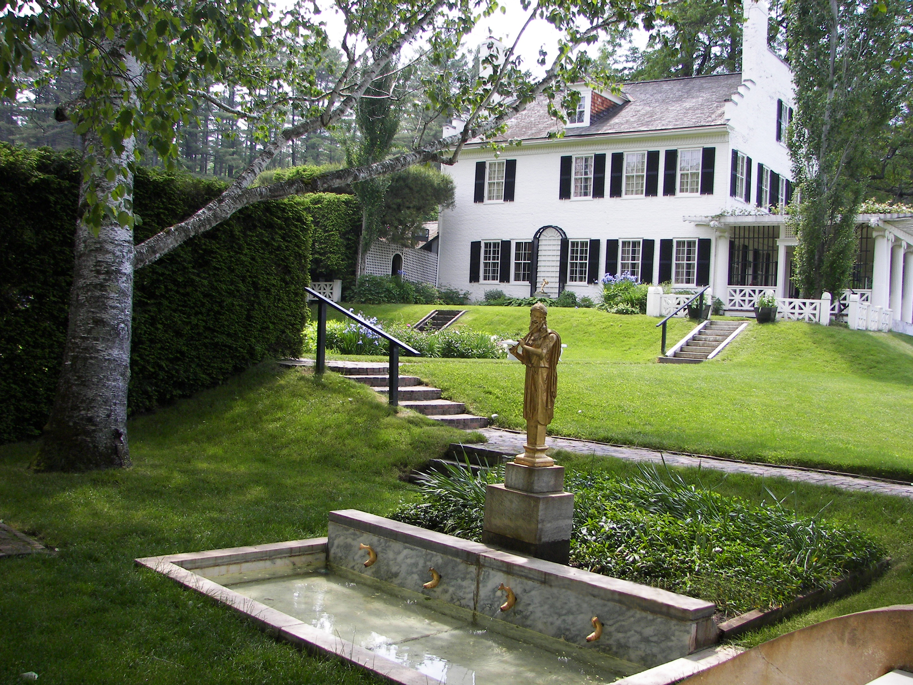
Built in 1817, Saint-Gaudens came here in 1885. He named it Aspet after the birthplace of his father in France.
Credit: NPS Photo
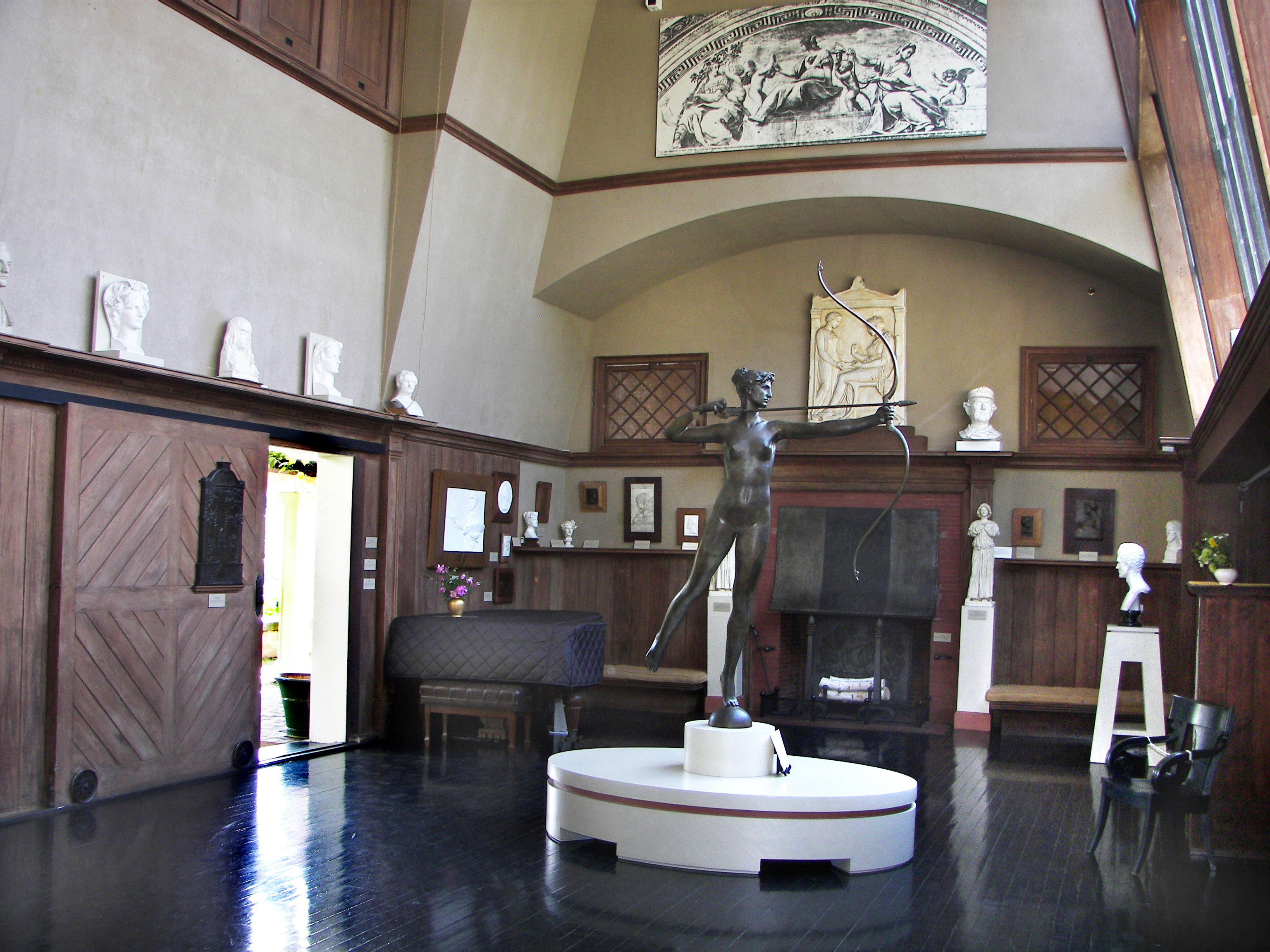
The Little Studio where Augustus Saint-Gaudens worked, exhibits some his well known works.
Credit: NPS Photo
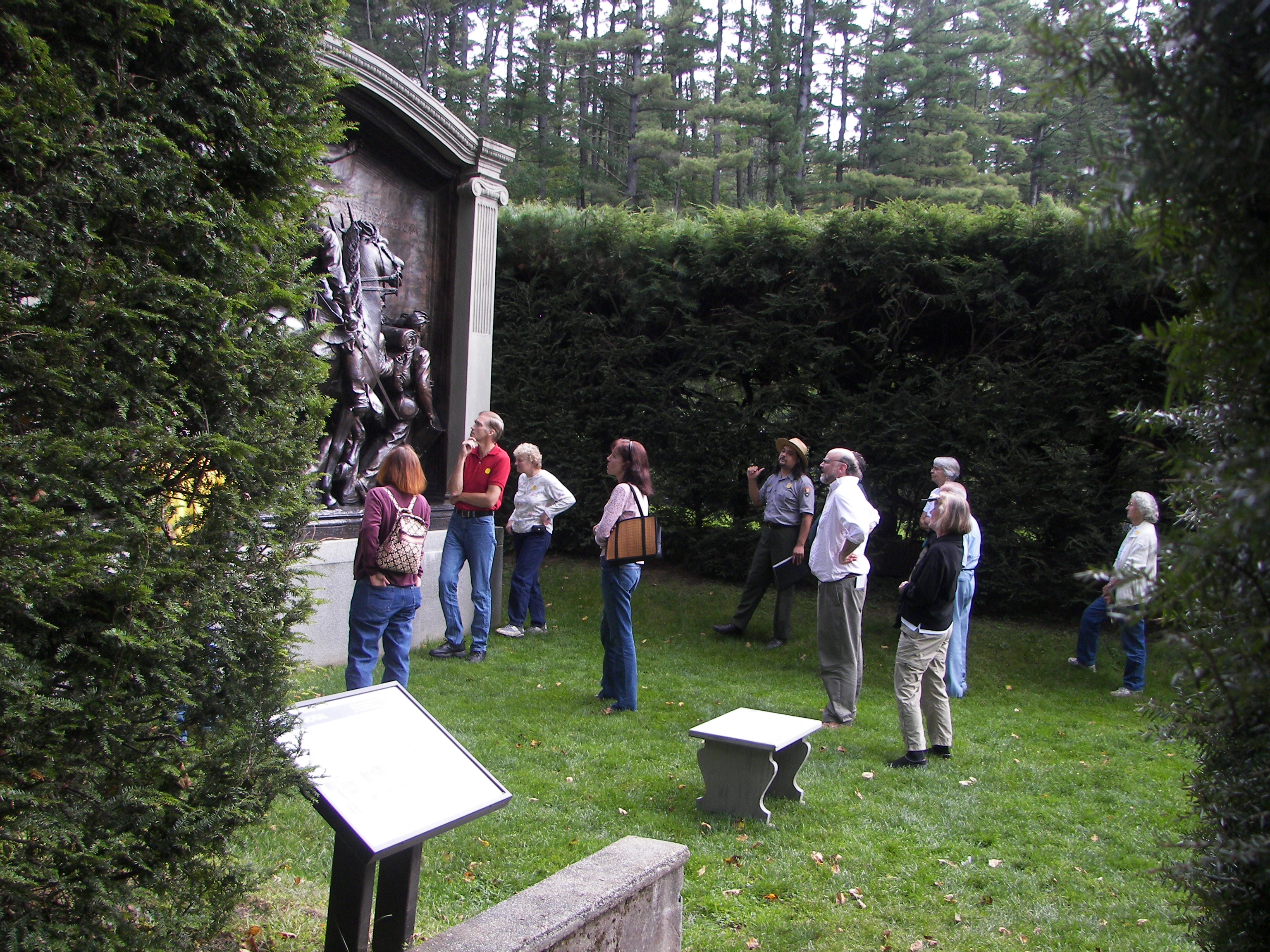
Visitors looking at the bronze cast of the Shaw Memorial, Saint-Gaudens' masterpiece.
Credit: NPS Photo
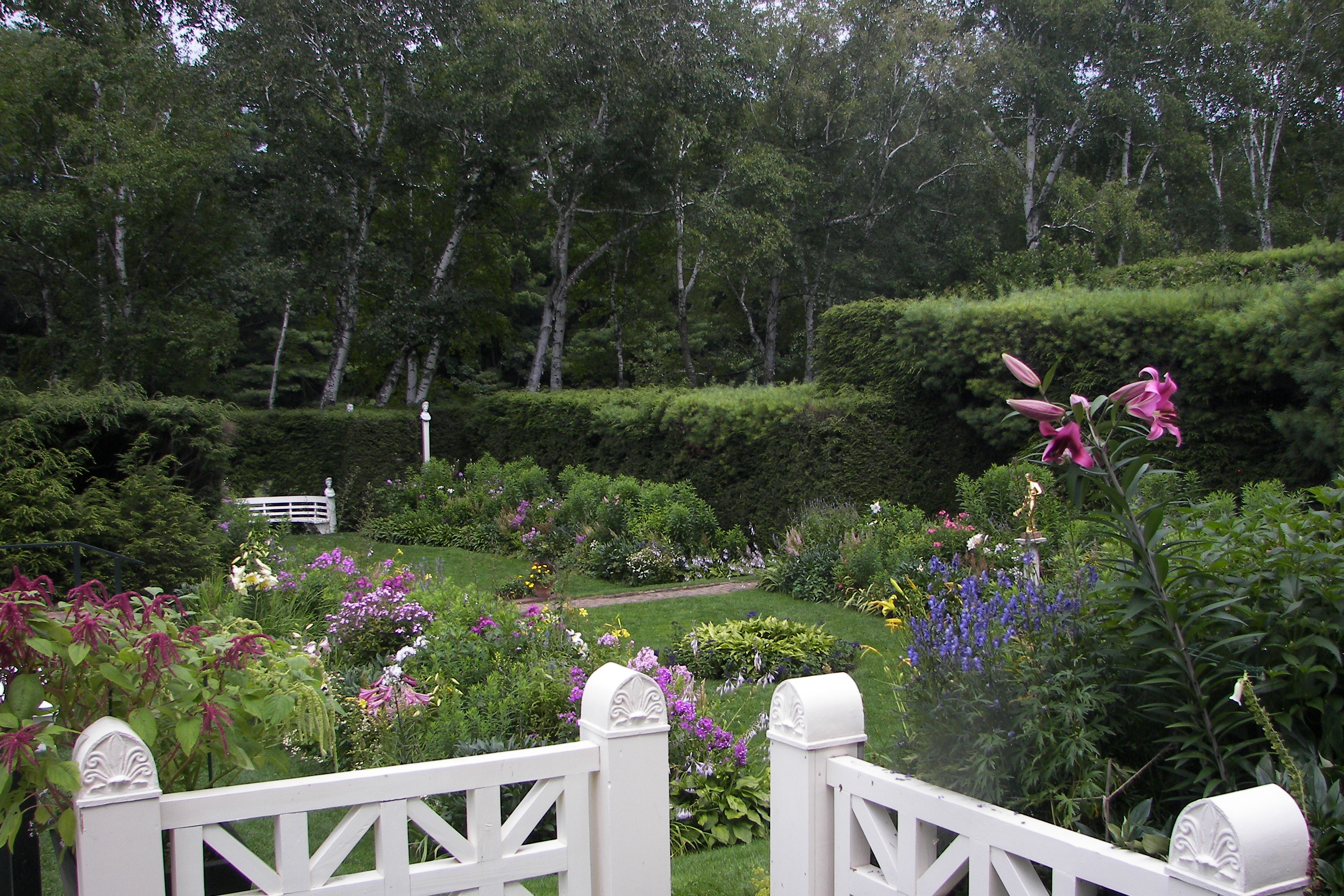
The Formal Gardens remain much like they were in the artist's time.
Credit: NPS Photo
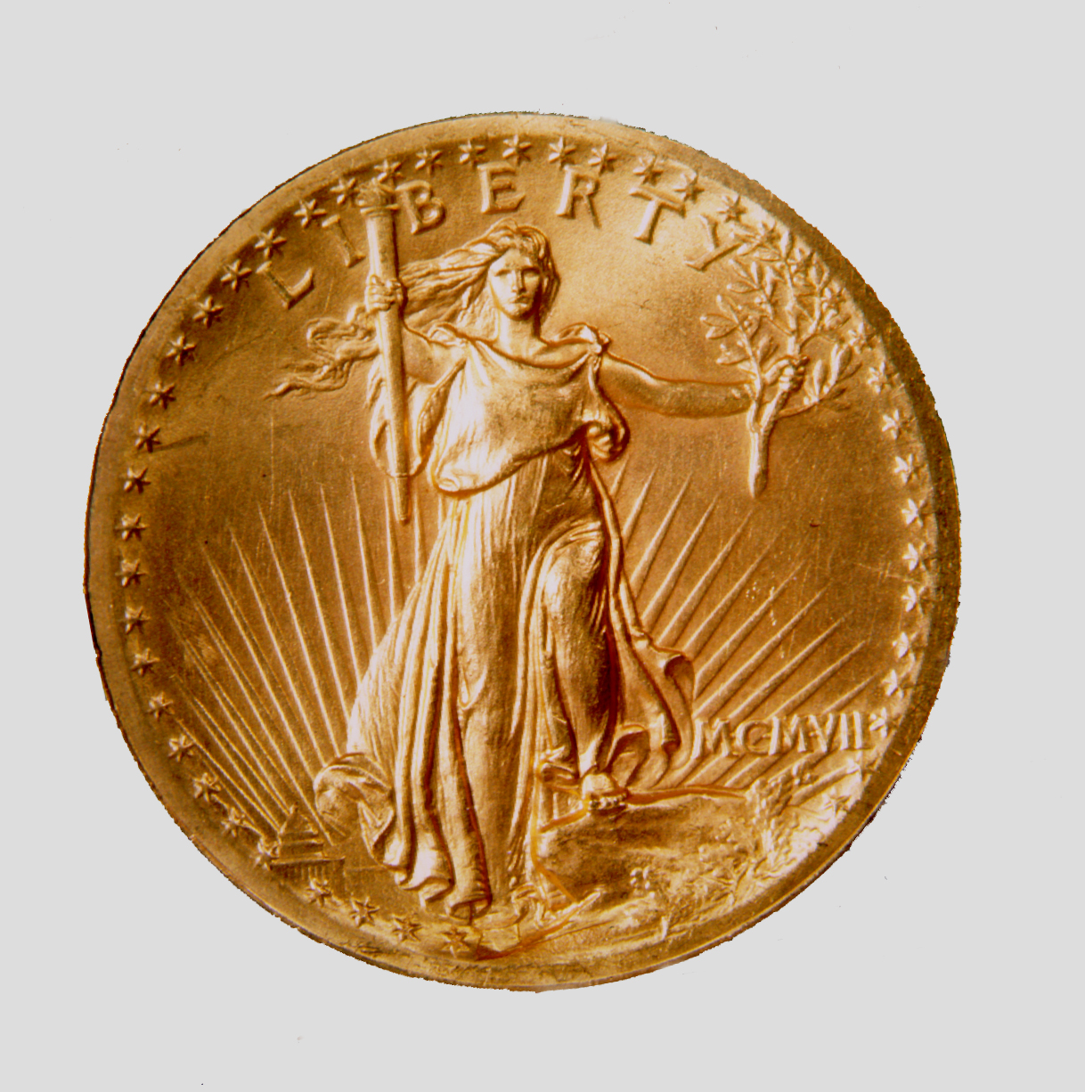
The 20 dollar gold piece Saint-Gaudens designed, is considered the most beautiful American coin ever minted
Credit: NPS Photo
Activities
Topics
Operating Hours
Entrance Fees
Entrance Passes
3-Day Weather Forecast
Friday, Dec 19

Moderate rain
High: 49.1°F | Low: 22°F
Humidity: 91%
Wind: 17.9 mph
Rain Chance: 89%
UV Index: 0
Sunrise: 07:19 AM
Sunset: 04:16 PM
Moon: New Moon (1%)
Visibility: 3 mi
Dew Point: 36.3°F
Cloud Cover: 89%
Pressure: N/A mb
Air Quality (PM2.5): N/A
Ozone: N/A
EPA Index: N/A
Saturday, Dec 20

Overcast
High: 24.9°F | Low: 14.2°F
Humidity: 63%
Wind: 18.3 mph
Rain Chance: 0%
UV Index: 0.2
Sunrise: 07:19 AM
Sunset: 04:16 PM
Moon: New Moon (0%)
Visibility: 5 mi
Dew Point: 13.7°F
Cloud Cover: 0%
Pressure: N/A mb
Air Quality (PM2.5): N/A
Ozone: N/A
EPA Index: N/A
Sunday, Dec 21
Overcast
High: 31.6°F | Low: 21°F
Humidity: 68%
Wind: 15.9 mph
Rain Chance: 0%
UV Index: 0.2
Sunrise: 07:20 AM
Sunset: 04:16 PM
Moon: Waxing Crescent (1%)
Visibility: 6 mi
Dew Point: 21.5°F
Cloud Cover: 0%
Pressure: N/A mb
Air Quality (PM2.5): N/A
Ozone: N/A
EPA Index: N/A
Weather Alerts (4)
Wind Advisory issued December 19 at 11:48AM EST until December 19 at 7:00PM EST by NWS Gray ME
Effective: Dec 19, 2025 11:48am
Expires: Dec 19, 2025 7:00pm
* WHAT...Southwest winds 10 to 20 mph with gusts up to 45 mph.
* WHERE...Portions of south central and southwest Maine and central
and southern New Hampshire.
* WHEN...Until 7 PM EST this evening.
* IMPACTS...Gusty winds will blow around unsecured objects. Tree
limbs could be blown down and a few power outages may result.
Strong winds will down tree limbs and blow around unsecured
objects. A few trees and power lines could be downed. The power
outage threat is elevated.
Wind Advisory issued December 19 at 12:59PM EST until December 20 at 7:00AM EST by NWS Burlington VT
Effective: Dec 19, 2025 12:59pm
Expires: Dec 20, 2025 4:00am
* WHAT...West winds 15 to 25 mph with gusts up to 50 mph expected.
* WHERE...Portions of northern New York and most of central,
eastern, and northern Vermont.
* WHEN...From 5 PM this afternoon to 7 AM EST Saturday.
* IMPACTS...Gusty winds will blow around unsecured objects. Tree
limbs could be blown down and additional power outages are
possible overnight into early Saturday morning.
* ADDITIONAL DETAILS...The peak secondary surge of gusty winds are
expected between 9 PM this evening and 3 AM Saturday morning.
Wind Advisory issued December 19 at 12:25PM EST until December 20 at 1:00AM EST by NWS Albany NY
Effective: Dec 19, 2025 12:25pm
Expires: Dec 20, 2025 1:00am
* WHAT...West winds 20 to 30 mph with gusts up to 50 mph.
* WHERE...Portions of northwestern Connecticut, eastern New York,
and southern Vermont.
* WHEN...Until 1 AM EST Saturday.
* IMPACTS...Gusty winds will blow around unsecured objects. Tree
limbs could be blown down and a few power outages may result.
* ADDITIONAL DETAILS...Winds continue to change direction this
afternoon to the west with the cold front moving through. Once the
front has passed, westerly winds continue into tonight. Winds
increase once again for the overnight hours tonight.
High Wind Warning issued December 19 at 12:25PM EST until December 20 at 1:00AM EST by NWS Albany NY
Effective: Dec 19, 2025 12:25pm
Expires: Dec 20, 2025 1:00am
* WHAT...West winds 20 to 30 mph with gusts between 50 and 58 mph.
* WHERE...In Massachusetts, Berkshire County. In New York, Eastern
Columbia and Eastern Rensselaer Counties. In Vermont, Bennington
County.
* WHEN...Until 1 AM EST Saturday.
* IMPACTS...Damaging winds will blow down trees and power lines.
Widespread power outages are expected. Travel will be difficult,
especially for high profile vehicles.
* ADDITIONAL DETAILS...Winds continue to change direction to the
west this afternoon with the cold front moving through. Once the
front has passed, westerly winds continue into tonight. Winds
increase again for the overnight hours tonight.
Park Alerts
Visitor Center & Contacts
📍 Physical Address:
139 Saint Gaudens Road
Cornish, NH 03745
🏤 Mailing Address:
139 Saint Gaudens Road
Cornish, NH 03745
📞 Voice Phone: 603-675-2175
✉️ Email: saga_info@nps.gov