Mount Rainier National Park
Designation: National Park
Location: Washington
📘 Park Overview
Ascending to 14,410 feet above sea level, Mount Rainier stands as an icon in the Washington landscape. An active volcano, Mount Rainier is the most glaciated peak in the contiguous U.S.A., spawning five major rivers. Subalpine wildflower meadows ring the icy volcano while ancient forest cloaks Mount Rainier’s lower slopes. Wildlife abounds in the park’s ecosystems. A lifetime of discovery awaits.
🌤 Weather Information
Weather patterns at Mount Rainier are strongly influenced by the Pacific Ocean and elevation. The climate is generally cool and rainy, with summer highs in the 60s and 70s. While July and August are the sunniest months of the year, rain is very likely in spring, fall, and winter. Visitors should be aware that mountain weather is very changeable. In the higher elevations, like Paradise, winter can last from November to May with many feet of snow on the ground.
🚗 Directions
Mount Rainier National Park is located in west-central Washington state. Several major cities in Washington- Seattle, Tacoma, and Yakima- and Portland, Oregon, are within 200 miles of the park. For GPS to Nisqually Entrance use: 39000 State Route 706 E, Ashford, WA 98304.
Images
The Silver Forest Trail at Sunrise features spectacular views of Mount Rainier and the White River valley.
Credit: JD Hascup Photo
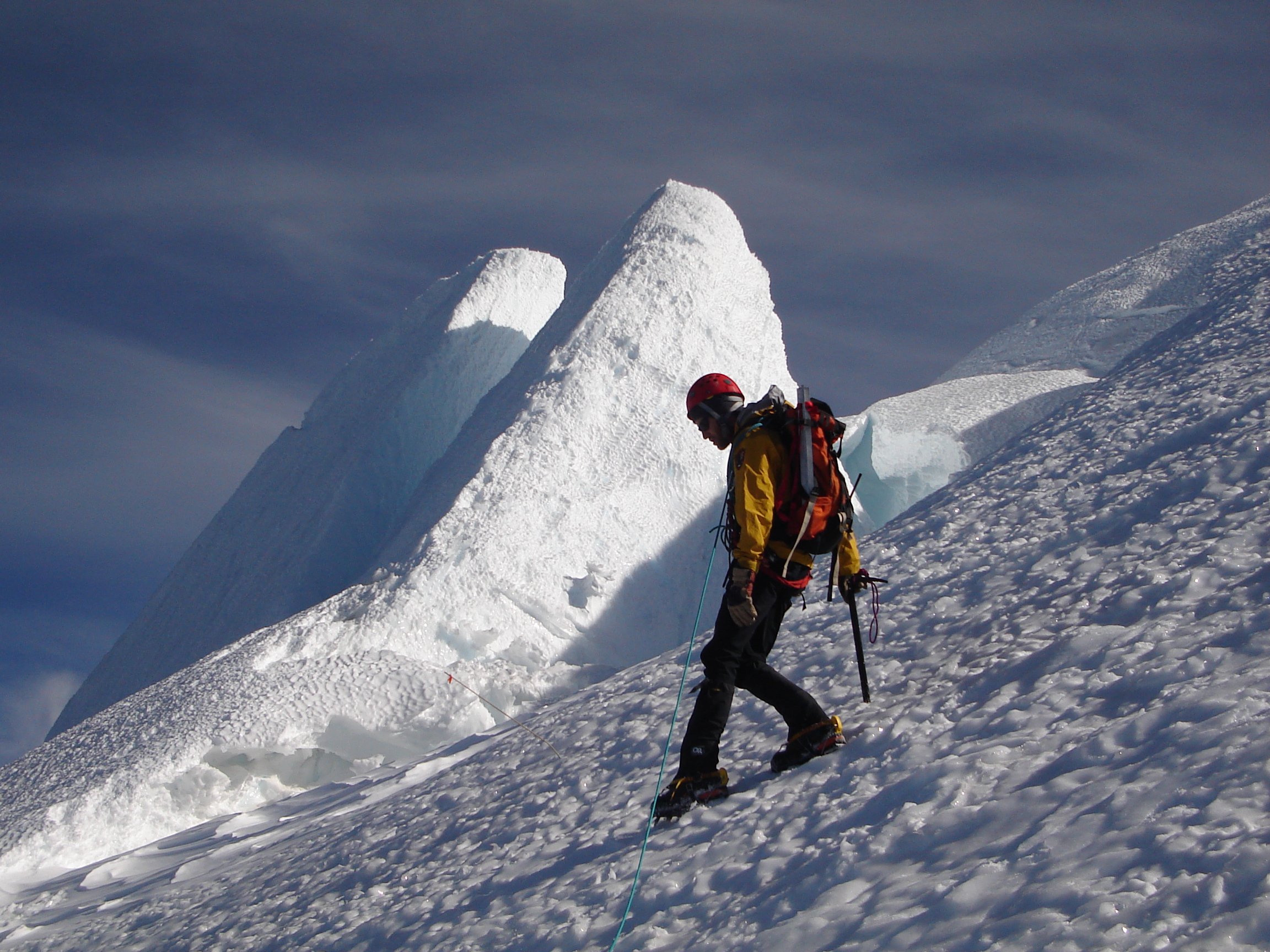
Summiting Mount Rainier involves climbing a volcano, scaling glaciers, dealing with high elevations and much more. Almost 10,000 people a year attempt to summit.
Credit: NPS Photo
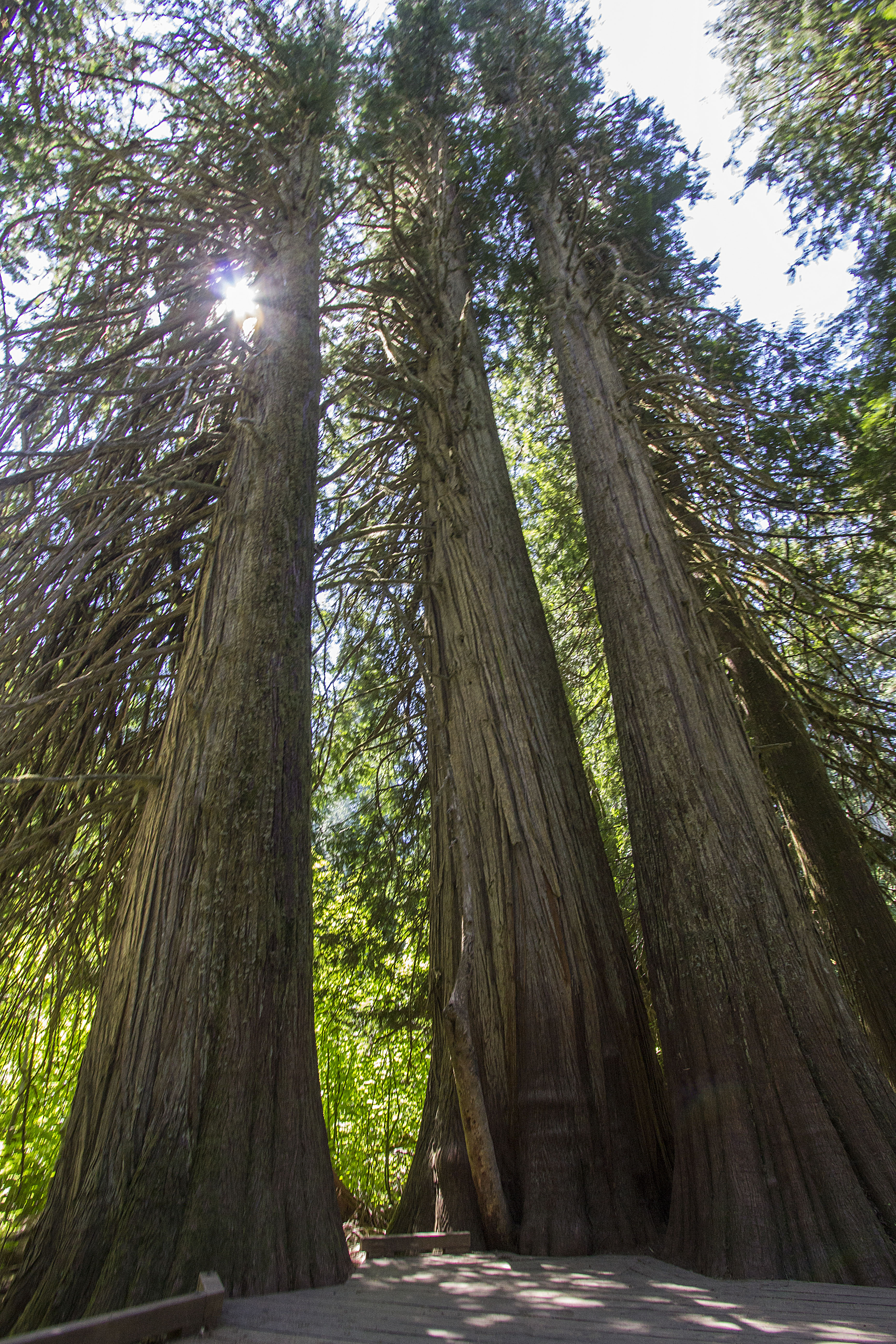
With some of the few remaining old-growth forests in the Cascade Mountains, Mount Rainier National Park protects native plants great and small in places like the Grove of the Patriarchs.
Credit: NPS Photo / Emily Brouwer
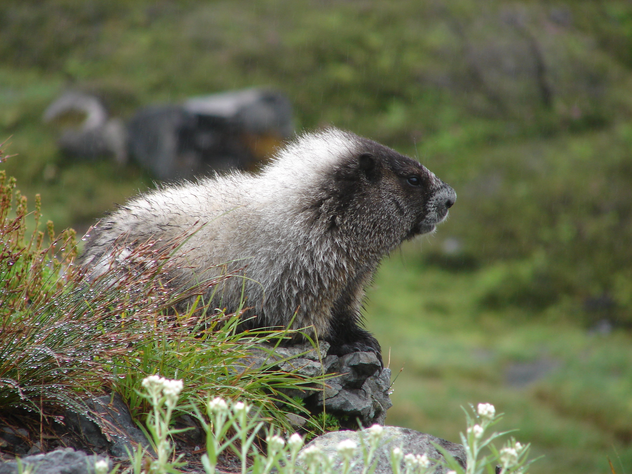
From small amphibians and hoary marmots to the black bears and elk, many animals call the wild places of Mount Rainier home.
Credit: NPS Photo
Enjoying the outdoors through recreation is a big part of many visitors' experiences.
Credit: NPS Photo / Steve Redman
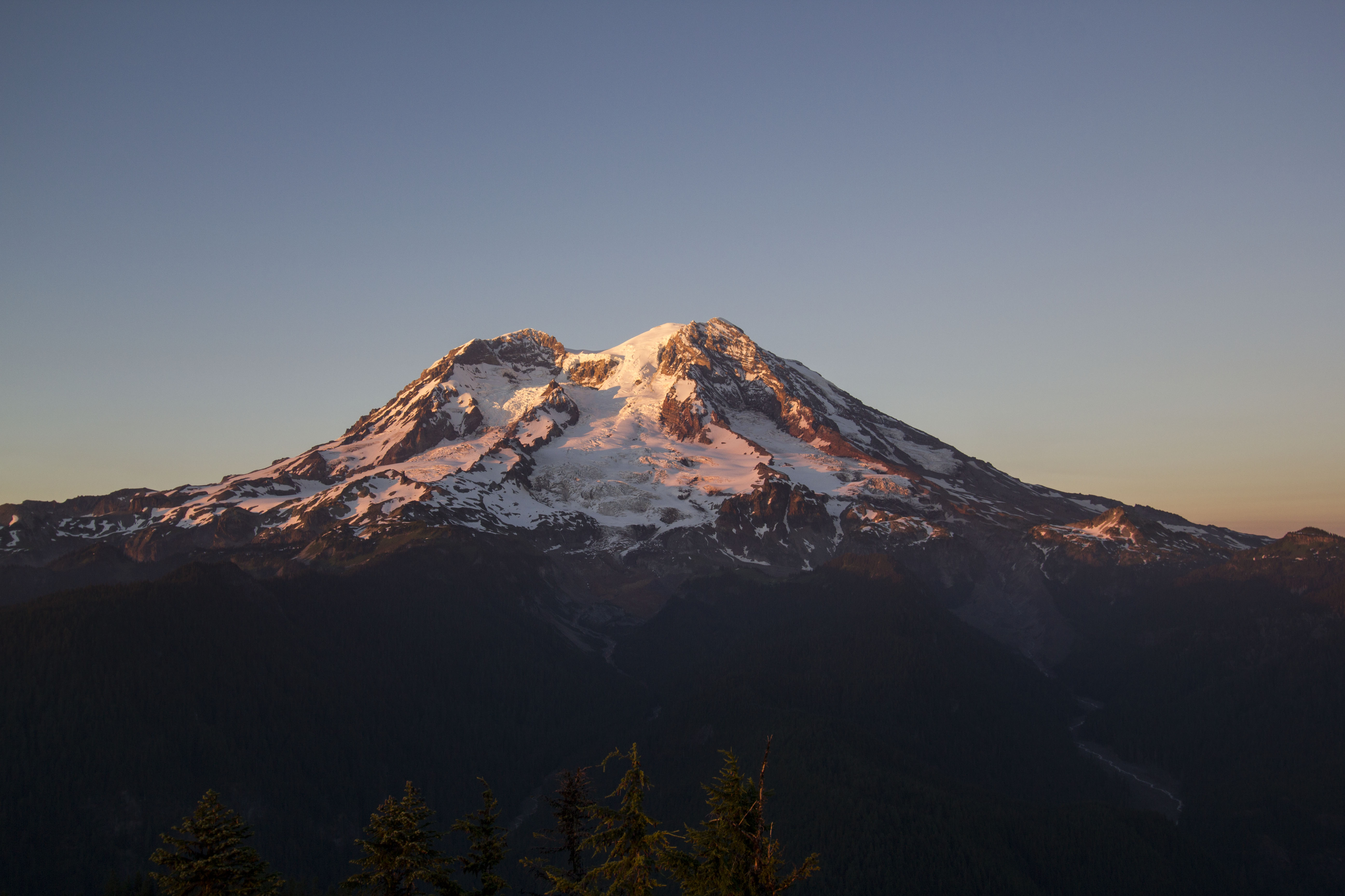
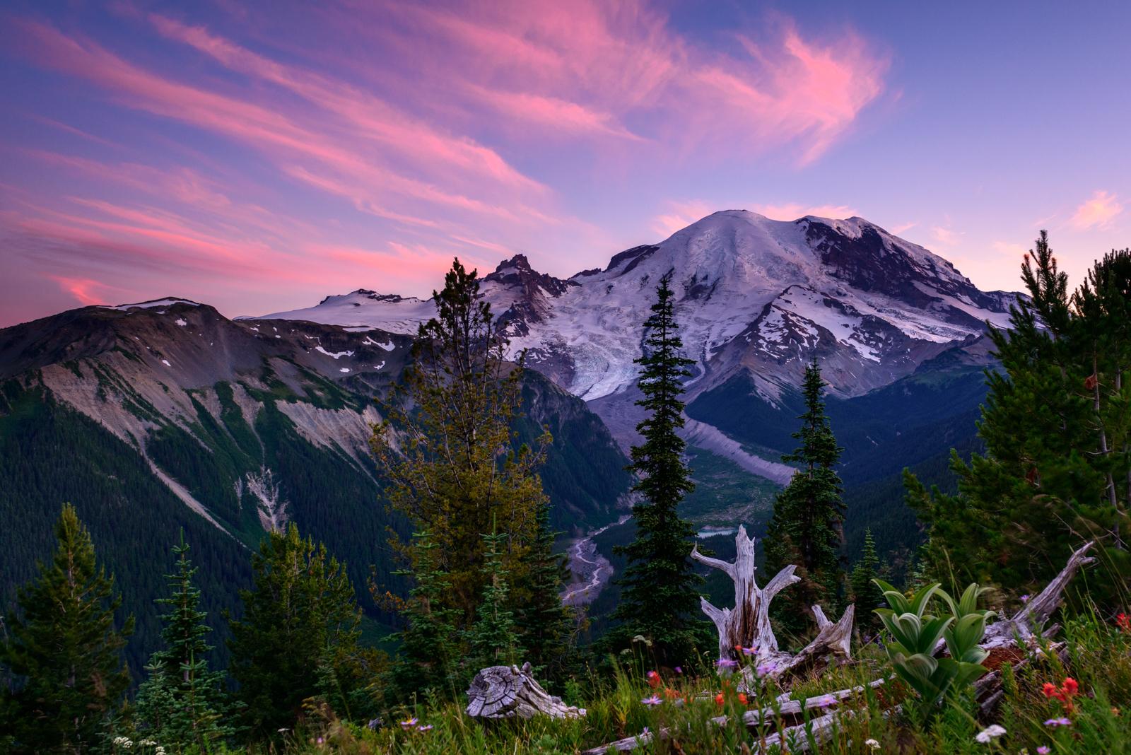
Every scenic overlook shows a different side of Mount Rainier. Viewed from Gobblers Knob Lookout at sunset, the glaciers covering the mountain turn pink and gold.
Credit: NPS Photo / Emily Brouwer
For thousands of years, people have traveled up to, over, and around Mount Rainier. Today the park strives to preserve this history while providing a chance for new generations to find their own adventures.
Credit: NPS Photo
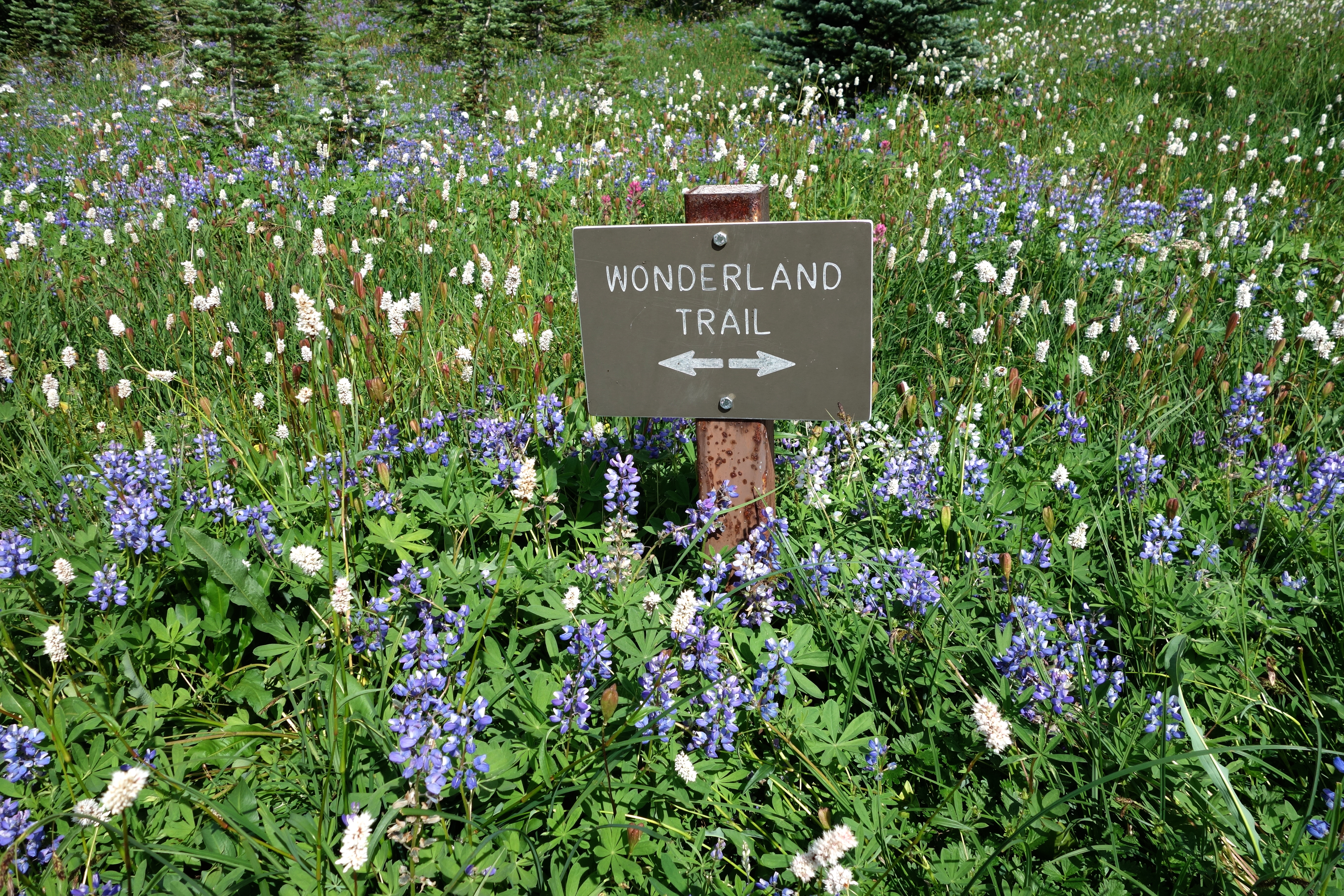
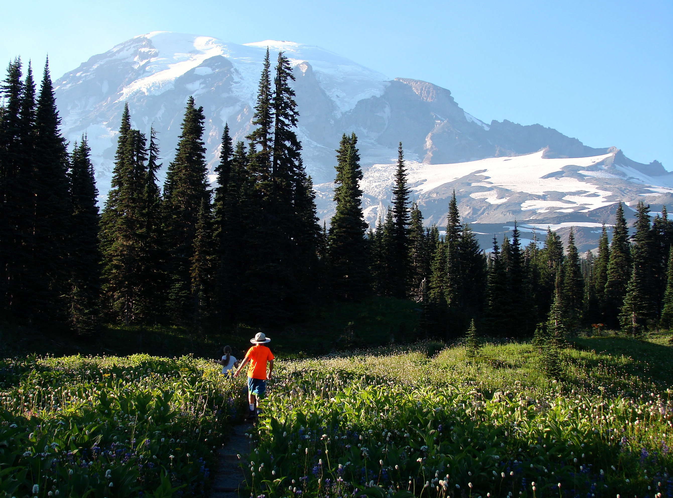
Both the Wonderland Trail and subalpine meadows encircle Mount Rainier. Summertime blooms splatter the hillsides with color.
Credit: NPS Photo/ K. Loving
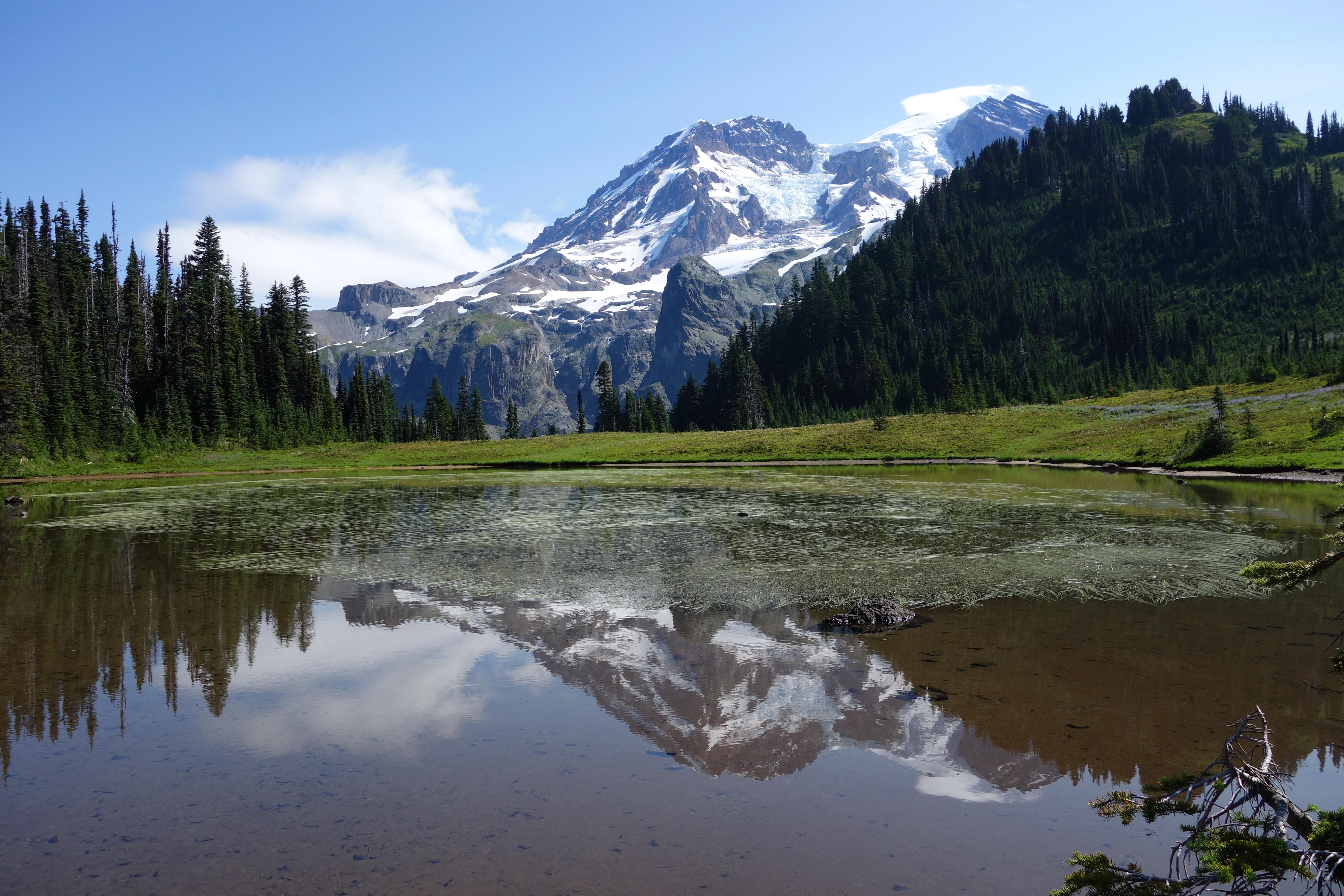
Aurora Lake in Klapatche Park on the west side of Mount Rainier.
Credit: NPS Photo
Activities
Topics
Operating Hours
Entrance Fees
Entrance Passes
3-Day Weather Forecast
Friday, Dec 19

Light freezing rain
High: 33.6°F | Low: 22.8°F
Humidity: 75%
Wind: 13 mph
Rain Chance: 63%
UV Index: 0.1
Sunrise: 07:47 AM
Sunset: 04:18 PM
Moon: New Moon (1%)
Visibility: 3 mi
Dew Point: 22.5°F
Cloud Cover: 63%
Pressure: N/A mb
Air Quality (PM2.5): N/A
Ozone: N/A
EPA Index: N/A
Saturday, Dec 20

Moderate or heavy snow showers
High: 33.3°F | Low: 21.7°F
Humidity: 85%
Wind: 6.9 mph
Rain Chance: 73%
UV Index: 0.1
Sunrise: 07:47 AM
Sunset: 04:18 PM
Moon: New Moon (0%)
Visibility: 2 mi
Dew Point: 26°F
Cloud Cover: 73%
Pressure: N/A mb
Air Quality (PM2.5): N/A
Ozone: N/A
EPA Index: N/A
Sunday, Dec 21
Moderate or heavy snow showers
High: 35.8°F | Low: 29.1°F
Humidity: 89%
Wind: 4.7 mph
Rain Chance: 84%
UV Index: 0.2
Sunrise: 07:48 AM
Sunset: 04:19 PM
Moon: Waxing Crescent (1%)
Visibility: 2 mi
Dew Point: 29.8°F
Cloud Cover: 84%
Pressure: N/A mb
Air Quality (PM2.5): N/A
Ozone: N/A
EPA Index: N/A
Weather Alerts (7)
Flood Warning issued December 19 at 7:30AM PST by NWS Seattle WA
Effective: Dec 19, 2025 10:30am
Expires: Dec 19, 2025 6:30pm
...The Flood Warning continues for the following rivers in
Washington...
White River Near Mud Mtn. Dam Outflow affecting Pierce and King
Counties.
.The river forecast is based on current dam operations. Dam
operations to maintain a safe flood pool for area dams could
maintain elevated flow levels or they could raise or lower levels
downstream of the dams. Dam regulation can change rapidly.
* WHAT...Minor flooding is occurring and minor flooding is forecast.
* WHERE...White River near Mud Mtn. Dam Outflow.
* WHEN...Until further notice.
* IMPACTS...At 8,000.0 cfs, the White River will spill over its
banks below Mud Mountain Dam producing high water that will
encroach on roads and residences, particularly in the Red Creek
area. 8000 cfs on the White River is within phase 3 flood in the
King County flood system.
* ADDITIONAL DETAILS...
- At 7:00 AM PST Friday the flow was 9,080.0 cfs.
- Flood flow is 9,000.0 cfs.
- Recent Activity...The maximum river flow in the 24 hours
ending at 7:00 AM PST Friday was 9,090.0 cfs.
- Forecast...The river is expected to fall to 9,500.0 cfs early
Monday morning.
- http://www.weather.gov/safety/flood
Flood Warning issued December 19 at 6:48AM PST by NWS Seattle WA
Effective: Dec 19, 2025 9:48am
Expires: Dec 19, 2025 6:00pm
...The Flood Warning continues for the following rivers in
Washington...
White River At R Street Bridge affecting Pierce and King Counties.
.The river forecast is based on current dam operations. Dam
operations to maintain a safe flood pool for area dams could
maintain elevated flow levels or they could raise or lower levels
downstream of the dams. Dam regulation can change rapidly.
* WHAT...Minor flooding is occurring and moderate flooding is
forecast.
* WHERE...White River at R Street Bridge.
* WHEN...Until further notice.
* IMPACTS...At 10,000.0 cfs, River flooding may occur upstream of
the A Street Bridge in the City of Auburn. River levels will
likely be up against the temporary flood protection barriers, with
flooding likely at Government Canal and Butte Avenue in the City
of Pacific and downstream of the Stewart Street Bridge in the City
of Sumner.
* ADDITIONAL DETAILS...
- At 5:45 AM PST Friday the flow was 8,930.0 cfs.
- Flood flow is 7,500.0 cfs.
- Recent Activity...The maximum river flow in the 24 hours
ending at 5:45 AM PST Friday was 10,100.0 cfs.
- Forecast...The river will continue to rise today before
leveling off around 10000 cfs by Saturday morning. It will
then hold steady into next week.
- http://www.weather.gov/safety/flood
Flood Watch issued December 19 at 4:27AM PST until December 20 at 10:00AM PST by NWS Seattle WA
Effective: Dec 19, 2025 7:27am
Expires: Dec 19, 2025 8:30pm
* WHAT...Flooding caused by excessive rainfall continues to be
possible.
* WHERE...Portions of northwest and west central Washington,
including the following counties, in northwest Washington, Grays
Harbor. In west central Washington, King, Lewis, Pierce and
Thurston.
* WHEN...Through Saturday morning.
* IMPACTS...Excessive runoff may result in flooding of rivers,
creeks, streams, and other low-lying and flood-prone locations.
Creeks and streams may rise out of their banks. Flooding may occur
in poor drainage and urban areas. Storm drains and ditches may
become clogged with debris. Area creeks and streams are running
high and could flood with more heavy rain.
* ADDITIONAL DETAILS...
- Rainfall from yesterday as well as expected showers today
will allow for continued reactions and possible rises on area
rivers. Additionally, those rivers that are seeing waters
recede may see the rate at which these waters fall slow down.
This will allow for potential flooding to continue into the
weekend.
- http://www.weather.gov/safety/flood
Flood Warning issued December 19 at 6:54AM PST until December 19 at 3:02PM PST by NWS Seattle WA
Effective: Dec 19, 2025 9:54am
Expires: Dec 19, 2025 6:00pm
...The Flood Warning continues for the following rivers in
Washington...
Cedar River At Renton affecting King County.
.The river forecast is based on current dam operations. Dam
operations to maintain a safe flood pool for area dams could
maintain elevated flow levels or they could raise or lower levels
downstream of the dams. Dam regulation can change rapidly.
* WHAT...No flooding is currently forecast.
* WHERE...Cedar River at Renton.
* WHEN...Until late this afternoon.
* IMPACTS...At 11.3 feet, the Cedar River will locally overflow its
banks, causing some areas of standing water, especially upstream
of Maple Valley in the Dorre Don area.
* ADDITIONAL DETAILS...
- At 6:15 AM PST Friday the stage was 12.9 feet.
- Flood stage is 13.0 feet.
- The river fell below flood stage early this morning, but only
to 12.8 feet. This is still very close to flood stage.
- Forecast...The river is expected to remain steady below flood
stage at 12.8 feet. As this remains very close to flood
stage, the flood warning will remain in effect for the time
being.
- http://www.weather.gov/safety/flood
Flood Warning issued December 19 at 6:45AM PST by NWS Seattle WA
Effective: Dec 19, 2025 9:45am
Expires: Dec 19, 2025 5:45pm
...The Flood Warning continues for the following rivers in
Washington...
Green River Near Auburn affecting King County.
.The river forecast is based on current dam operations. Dam
operations to maintain a safe flood pool for area dams could
maintain elevated flow levels or they could raise or lower levels
downstream of the dams. Dam regulation can change rapidly.
* WHAT...Minor flooding is occurring and minor flooding is forecast.
* WHERE...Green River near Auburn.
* WHEN...Until further notice.
* IMPACTS...At 9,000.0 cfs, the Green River will flood low areas of
the middle Green River valley with water over SE Green Valley Rd.
Some backwater inundation is possible in lower Mill Creek basin
between Auburn and Kent. A flow of 9000 cfs feet on the Green
River corresponds to a phase 3 flood in the King County flood
system.
* ADDITIONAL DETAILS...
- At 5:45 AM PST Friday the flow was 9,730.0 cfs.
- Flood flow is 9,000.0 cfs.
- Recent Activity...The maximum river flow in the 24 hours
ending at 5:45 AM PST Friday was 9,760.0 cfs.
- Forecast...The river is expected to remain near 9,700 cfs
today then slowly drift lower over the next several days but
remain above flood flow at least through the weekend.
- http://www.weather.gov/safety/flood
Flood Warning issued December 19 at 7:37AM PST by NWS Seattle WA
Effective: Dec 19, 2025 10:37am
Expires: Dec 19, 2025 6:45pm
...The Flood Warning continues for the following rivers in
Washington...
Cowlitz River Below Mayfield Dam affecting Lewis County.
.Dam operations to reduce the flood pool for area dams will maintain
elevated flow levels below the dams. Any new rainfall overnight
will increase inflows into the reservoirs.
* WHAT...Minor flooding is occurring and minor flooding is forecast.
* WHERE...Cowlitz River below Mayfield Dam.
* WHEN...Until further notice.
* IMPACTS...At 25,000.0 cfs, the Cowlitz River will flood the reach
from Mayfield Dam downstream through Toledo. Flood waters will
inundate some farmlands and several roads...mainly near Toledo.
* ADDITIONAL DETAILS...
- At 7:00 AM PST Friday the flow was 28,100.0 cfs.
- Flood flow is 25,000.0 cfs.
- Recent Activity...The maximum river flow in the 24 hours
ending at 7:00 AM PST Friday was 28,500.0 cfs.
- Forecast...The river is expected to rise to 28,200.0 cfs late
this morning. Additional rises are possible thereafter.
- Flood History...This crest compares to a previous crest of
27,900.0 cfs on 01/26/1947.
- http://www.weather.gov/safety/flood
Flood Warning issued December 19 at 7:37AM PST until December 20 at 6:52AM PST by NWS Seattle WA
Effective: Dec 19, 2025 10:37am
Expires: Dec 19, 2025 6:45pm
...Forecast flooding changed from Minor to Moderate severity and
increased in duration for the following rivers in Washington...
Cowlitz River At Randle affecting Lewis County.
.Rainfall from Thursday will continue to fuel rises in river levels
Friday. River levels are expected to fall over the weekend.
* WHAT...Minor flooding is occurring and moderate flooding is
forecast.
* WHERE...Cowlitz River at Randle.
* WHEN...Until tomorrow morning.
* IMPACTS...At 20.0 feet, the Cowlitz River will cause flooding from
the vicinity of Randle downstream through Riffe Lake...inundating
many roads including US Highway 12 and much of the farm lands.
* ADDITIONAL DETAILS...
- At 7:30 AM PST Friday the stage was 19.7 feet.
- Flood stage is 18.0 feet.
- Recent Activity...The maximum river stage in the 24 hours
ending at 7:30 AM PST Friday was 19.7 feet.
- Forecast...The river is expected to rise to a crest of 20.0
feet late this morning. It will then fall below flood stage
late this evening.
- Flood History...This crest compares to a previous crest of
19.8 feet on 10/31/1997.
- http://www.weather.gov/safety/flood
Park Alerts
Park Events
Fee Free Day - President's Day
All entrance fees are waived in recognition of President's Day (Washington's Birthday).
Date: Feb 16, 2026 12:00am to Feb 16, 2026 12:00am
Paid Event
Fee Free Day - Memorial Day
All entrance fees are waived in recognition of Memorial Day.
Date: May 25, 2026 12:00am to May 25, 2026 12:00am
Paid Event
Fee Free Day - Flag Day
All entrance fees are waived in recognition of Flag Day (President Trump's Birthday).
Date: Jun 14, 2026 12:00am to Jun 14, 2026 12:00am
Paid Event
Fee Free Days - Independence Day Weekend
All entrance fees are waived in celebration of Indepence Day weekend, July 3-5.
Date: Jul 3, 2026 12:00am to Jul 5, 2026 12:00am
Paid Event
Fee Free Day - National Park Service Birthday
Date: Aug 25, 2026 12:00am to Aug 25, 2026 12:00am
Paid Event
Fee Free Day - Constitution Day
Date: Sep 17, 2026 12:00am to Sep 17, 2026 12:00am
Paid Event
Fee Free Day - Theodore Roosevelt's Birthday
Date: Oct 27, 2026 12:00am to Oct 27, 2026 12:00am
Paid Event
Fee Free Day - Veterans Day
All entrance fees waived in recognition of Veterans Day.
Date: Nov 11, 2026 12:00am to Nov 11, 2026 12:00am
Paid Event
Visitor Center & Contacts
📍 Physical Address:
55210 238th Avenue East
Ashford, WA 98304
🏤 Mailing Address:
55210 238th Avenue East
Ashford, WA 98304
📞 Voice Phone: 3605692211
📞 Fax Phone: 3605696519
📞 TTY Phone: 3605692177
✉️ Email: morainfo@nps.gov