Isolation over thousands of years has created unique animals, plants, and archeological resources found nowhere else on Earth and helped preserve a place where visitors can experience coastal southern California as it once was.
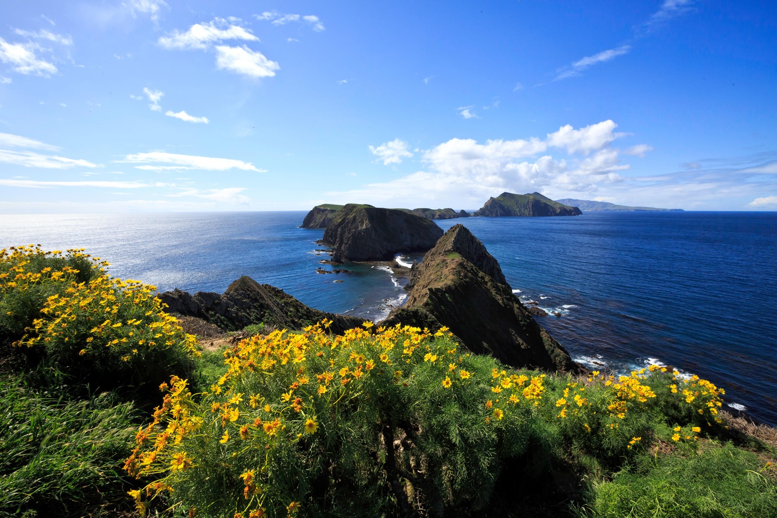 Photo: Tim Hauf, timhaufphotography.com
Channel Islands National Park
Channel Islands National Park encompasses five remarkable islands and their ocean environment, preserving and protecting a wealth of natural and cultural resources.
- LocationVentura, CA
- Entrance No fee listed
- HoursOpen 24 hours, daily
-
 Weather now64°F Patchy rain nearby
- Alerts 2 active alerts
Overview
Topics
- Animals
- Archeology
- Architecture and Building
- Astronomy
- Birds
- Climate Change
- Coastal Defenses
- Coasts, Islands and Atolls
40 more topics
- Colonization and Settlement
- Commerce
- Dunes
- Endangered
- Estuaries and Mangroves
- Explorers and Expeditions
- Farming and Agriculture
- Fire
- Fish
- Forests and Woodlands
- Fossils and Paleontology
- Geology
- Grasslands
- Lighthouses
- Maritime
- Maritime - Military
- Marshes
- Military
- Monuments and Memorials
- Mountains
- Native American Heritage
- Natural Sounds
- Night Sky
- Oceans
- Piracy and Privateering
- Ranches
- Rare
- River and Riparian
- Scenic Views
- Ships and Shipwrecks
- Thickets and Shrublands
- Trade
- Trails
- Unique Species
- US Coast Guard
- US Navy
- Watersheds
- Wetlands
- Whales
- Wilderness
Alerts (2)
Park ClosureParts of Santa Rosa Island Closed During Wildfire Recovery Santa Rosa Island is open to limited day use. Burned areas remain closed and overnight use is prohibited. Water Canyon C… Read more
Santa Rosa Island is open to limited day use. Burned areas remain closed and overnight use is prohibited. Water Canyon Campground is currently closed, but will reopen October 14, as will backcountry beach camping in northwest and southwest quadrants. Click the more link for additional information.
InformationSanta Barbara Island Dock Closed; Landings Restricted to Adjacent Rocky Ledge Santa Barbara Island is open to public access, but landings are restricted to the rocky ledge adjacent to the dock. The… Read more
Santa Barbara Island is open to public access, but landings are restricted to the rocky ledge adjacent to the dock. The dock is closed and is not expected to be repaired in the near future due to the severe winter storm damage.
Things to Do
37 activities. Pick one to find other parks that offer it.
- Hiking
- Camping
- Wildlife Watching
- Stargazing
- Astronomy
- Fishing
- Boating
- Paddling
- Swimming
- Guided Tours
- Birdwatching
- Junior Ranger Program
Show 25 more activities
- Museum Exhibits
- Picnicking
- Backcountry Camping
- Backcountry Hiking
- Boat Tour
- Bookstore and Park Store
- Canoe or Kayak Camping
- Compass and GPS
- Food
- Front-Country Hiking
- Group Camping
- Kayaking
- Motorized Boating
- Off-Trail Permitted Hiking
- Orienteering
- Park Film
- Sailing
- Saltwater Fishing
- Saltwater Swimming
- SCUBA Diving
- Self-Guided Tours - Walking
- Shopping
- Snorkeling
- Stand Up Paddleboarding
- Surfing
Camping
8 campgrounds listed on Recreation.gov. Check availability and current conditions before you go.
-
Anacapa Island
Reservable Campground
Once visitors have scaled the rugged cliffs using the stairwell from the Landing Cove, they will be rewarded with a campground perched on the bluffs with magnificent…
Reserve on Recreation.gov- Hiking
- Fishing
- Boating
- Swimming
Details
Overview
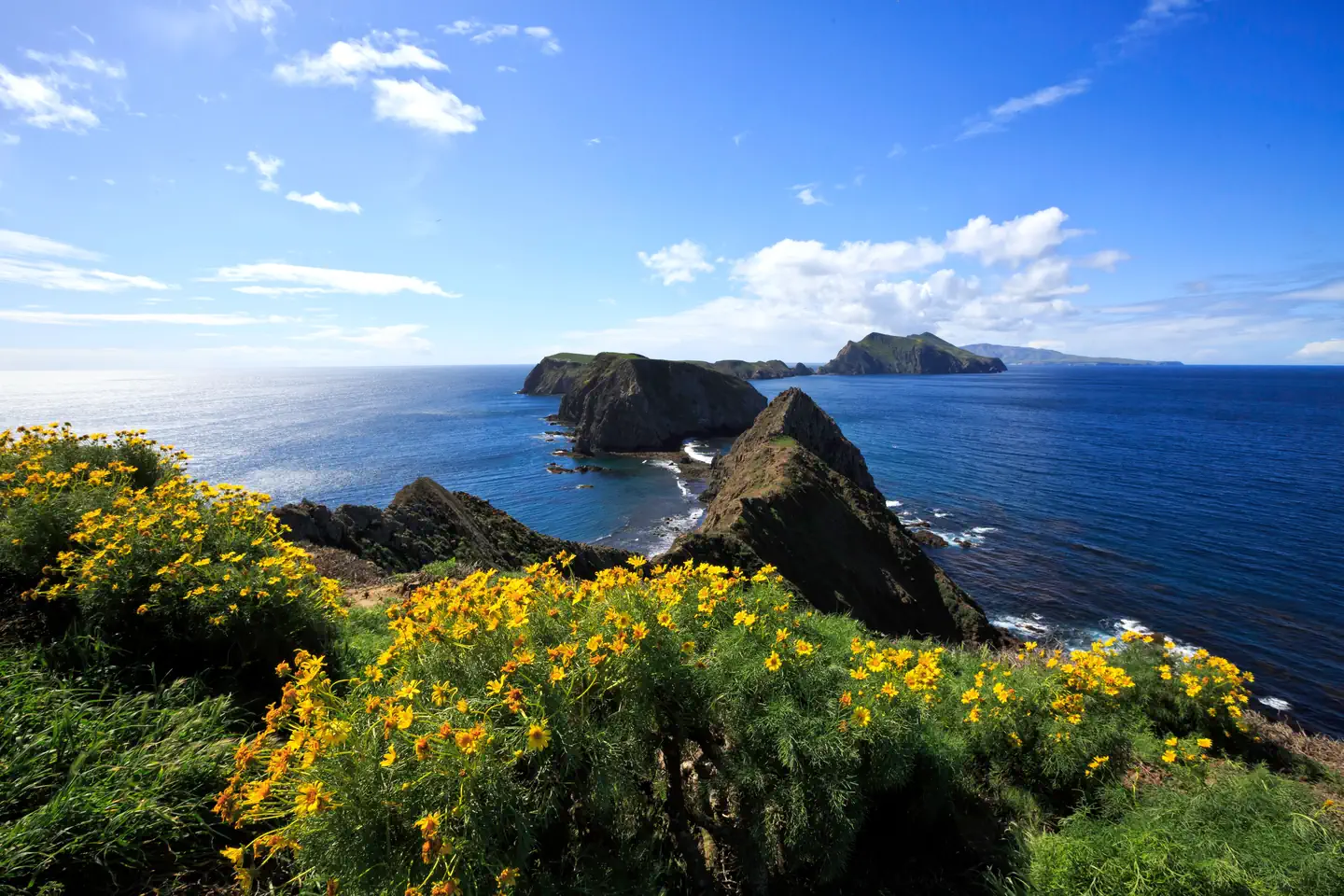
Once visitors have scaled the rugged cliffs using the stairwell from the Landing Cove, they will be rewarded with a campground perched on the bluffs with magnificent coastal views.
Anacapa Island, the closest Channel Island to the mainland of California, is comprised of three islets (appropriately named East, Middle, and West Anacapa Islands). Waves have eroded the volcanic island, creating towering sea cliffs, sea caves, and natural bridges, such as forty-foot-high Arch Rock -- a symbol of Anacapa and Channel Islands National Park.
Exploring East Anacapa's two-mile trail system allows visitors to experience the island's native vegetation, wildlife, and cultural history. The islands' native vegetation is recovering slowly with the help of the National Park Service's restoration efforts. This recovery, along with the removal of nonnative predators, has aided in the reestablishment of nesting land birds and seabirds. The island is one of the most important seabird nesting sites within the Channel Islands. While the steep cliffs of West Anacapa are home to the largest breeding colony of endangered California brown pelicans, all the islets of Anacapa host the largest breeding colony of western gulls in the world.
The rocky shores of Anacapa are perfect resting and breeding areas for California sea lions and harbor seals. Anacapa's rich kelp forests (ideal for kayaking, snorkeling, and diving) and tidepool areas provide visitors with the opportunity to meet some of the resident ocean animals up close.
Anacapa Island has a rich human history as well. Shell midden sites indicate where Chumash people camped on the islands thousands of years ago. In addition, visitors can view the 1932 light station. The original lead-crystal Fresnel lens, which served as a beacon to ships until an automated light replaced it in 1990, is on exhibit in the East Anacapa Visitor Center.
Recreation
With two miles of hiking trails, ocean access nearby the campground, and generally good weather, Anacapa Island offers a variety of recreational activities, including hiking, swimming, snorkeling, diving, kayaking and wildlife/wildflower viewing. In summer, rangers lead an underwater video program. The program includes live video footage of sea life which is projected for visitors to see. It's a great way to stay dry while viewing colorful sea creatures.
Since Anacapa Island is a cliff island, access to the water is only at the Landing Cove via a dock. There are no other accessible beaches unless you have a watercraft. There are no services on the island, so all gear has to be brought to the island. For more information about recreational activities in the park, visit https://www.nps.gov/chis/planyourvisit/index.htm.
Facilities
A half mile hike, including 154 steps, is needed to get from the Landing Cove to the seven-site (4-6 persons per site) campground. Camping is primitive and campers must bring their own food, equipment and water. Picnic table, food storage box, and pit toilet are provided.Natural Features
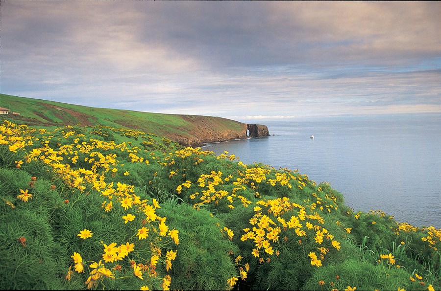
Waves have eroded the 5-mile volcanic island, creating steep, towering sea cliffs, sea caves and natural bridges. Much of the year, the island vegetation looks brown, but the winter rain brings brightly-colored terrain. The altitude is low and ranges from sea level to 250 feet.Nearby Attractions
The Landing Cove near the campground is an ideal place for swimming, diving, snorkeling and kayaking, but there are no lifeguards on the island. The island is also home to just over two miles of trails that meander to dramatic overlooks and magnificent coastal views. All hikers must stay on the trails for visitor safety and to protect fragile vegetation and nesting seabirds. No off- trail hiking is allowed. -
San Miguel Island
Reservable Campground
Wind and weather constantly sweep across the North Pacific to batter the shores of this westernmost of all the islands. This extreme weather creates a harsh but…
Reserve on Recreation.gov- Hiking
- Fishing
- Boating
- Swimming
Details
Overview
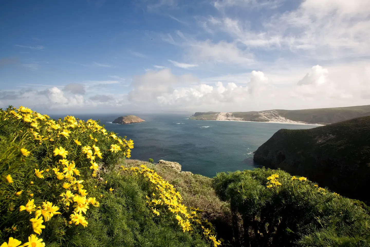
Wind and weather constantly sweep across the North Pacific to batter the shores of this westernmost of all the islands. This extreme weather creates a harsh but profoundly beautiful environment. Although it can be challenging to reach the San Miguel Island Campground, it's always worth the effort. Perched on a plateau, the campground offers incredible island views and access to a variety of recreational activities and unique natural and cultural resources.
Although a century's worth of sheep ranching and overgrazing caused scientists in 1875 to describe the island as "a barren lump of sand," with the grazing animals removed, vegetative recovery is in progress. Giant coreopsis, dudleya, locoweed, lupine, buckwheat, coastal sagebrush, and poppies are all recolonizing the island to their former extent, returning San Miguel to its more natural state.
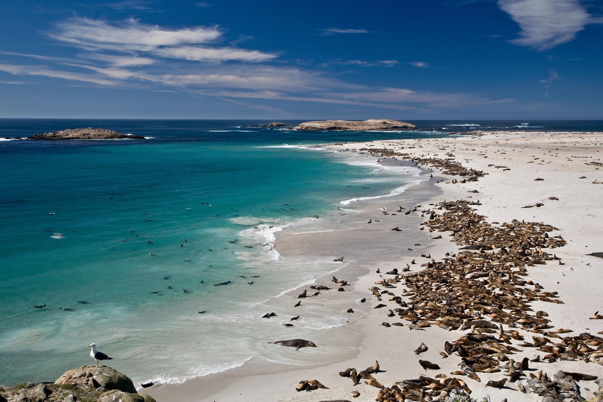
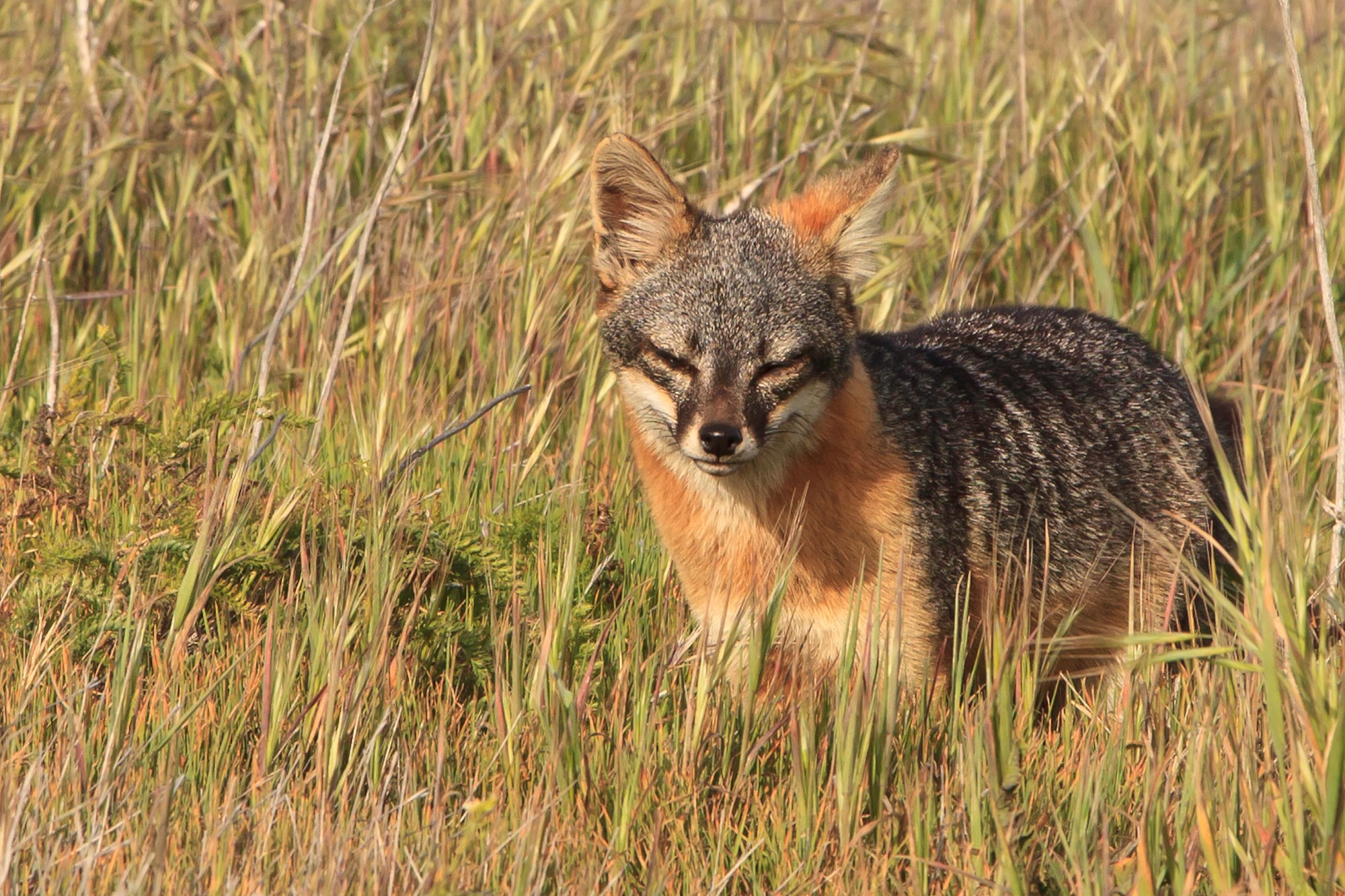
Also making a comeback, after years of hunting, are the thousands of pinnipeds (seals and sea lions) that breed, pup, and haul out on the island's 27 miles of isolated coastline. Other wildlife include a variety of landbirds, 13 nesting seabird species, and unique animals like the island fox and deer mouse. Both of these little creatures are endemics -- they are found only on the Channel Islands.
In addition to the variety of natural resources, San Miguel hosts an array of cultural resources as well. The Chumash and their ancestors lived on San Miguel almost continuously for nearly 12,000 years. Juan Rodriguez Cabrillo and his men laid eyes on San Miguel Island in 1542 which is commemorated by a monument on the island.
Other outstanding island resources that visitors may experience on San Miguel include the caliche forest (sand-castings of ancient vegetation), fossil bones of the Pleistocene pygmy mammoths that stood four to six feet at the shoulders, 150 years of ranching history and numerous shipwrecks.
Recreation
A permit (including liability waiver) is required to visit the island. If you are traveling to San Miguel Island with Island Packers, Channel Islands Aviation, or Truth Aquatics, they will provide the forms to you upon your reservation. Private boaters can obtain the forms at a self-registration station at the Nidever Canyon trailhead entry on San Miguel Island.
Several trails traverse San Miguel Island providing visitors with spectacular hiking opportunities. While many parts of the island are closed to protect wildlife, fragile plants, and geological features, several areas are open for you to explore. Visitors may explore the two-mile-long Cuyler Harbor beach and one-mile-long trail to the ranger station on their own. To see other parts of the island, such as Point Bennett or the caliche forest, you must go with a ranger or volunteer. If arriving with a concessionaire, park staff are usually available to offer guided hikes. However, there is no guarantee that hikes will be offered to all locations. Visitors must coordinate with island staff upon arrival. All hikers must stay on the trails to protect fragile vegetation and for visitor safety. No off-trail hiking is allowed.
Due to the strong, persistent wind, swimming, snorkeling, diving and kayaking are limited and recommended for the experienced visitor only. In addition, landing and beach access is only allowed at Cuyler Harbor. No fishing is allowed within the marine reserves located around the island. Fishing is allowed outside of these areas.
For more information about recreational activities in the park, visit https://www.nps.gov/chis/planyourvisit/index.htm.
Facilities
A one mile, steep uphill hike from the boat landing in Cuyler Harbor to the 9-site campground is required. If you fly in, then its a short, flat 1/4 mile hike. Camping is primitive and campers must bring their own food, equipment and water. Picnic table, five-foot tall windbreak, food storage box and pit toilet are provided.Natural Features
The 9,500-acre island is a plateau at 500 feet in elevation, with two 800-ft. rounded hills and 27 miles of coastline. As the westernmost island in the park, the weather can be windy anytime of the year -- 30 knots of wind is not uncommon.Nearby Attractions
Despite the wind, Cuyler Harbor (one-mile from the campground) is one of the most scenic beaches in the park. Beach access is only allowed at Cuyler Harbor. The guided, 16-mile roundtrip hike to Point Bennett requires some stamina, but visitors are rewarded with the chance to see one of the largest congregations of wildlife in the world-over 30,000 animals and up to five different species. All hikers must stay on the trails for visitor safety and to protect fragile vegetation and nesting seabirds. No off-trail hiking is allowed. -
Santa Barbara Island
Reservable Campground
Once visitors have scaled the rugged cliffs using the steep trail from the Landing Cove, they will be rewarded with a campground perched on the bluffs with magnificent…
Reserve on Recreation.gov- Hiking
- Fishing
- Boating
- Swimming
Details
Overview
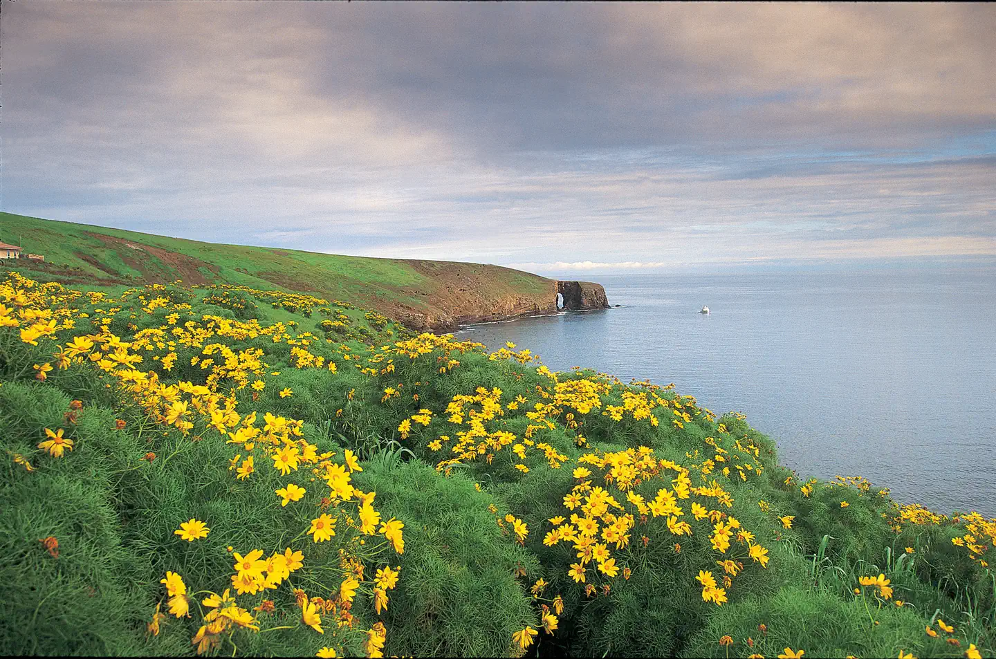
Once visitors have scaled the rugged cliffs using the steep trail from the Landing Cove, they will be rewarded with a campground perched on the bluffs with magnificent coastal views.
Santa Barbara lies much further south than the other four northern Channel Islands and is the smallest, measuring just one square mile. The islands' native vegetation is recovering slowly with the help of the National Park Service's restoration efforts. This recovery, along with the removal of nonnative predators, has aided in the reestablishment of nesting land birds and seabirds. The island is one of the most important seabird nesting sites within the Channel Islands, with 11 nesting species, including western gulls, California brown pelicans, three species of cormorants, three species of storm-petrels, and one of the world's largest colonies of Scripps's murrelets. The rocky shores of Santa Barbara Island also provide resting and breeding areas for California sea lions, harbor seals and northern elephant seals.
Recreation
With five miles of hiking trails, ocean access nearby the campground and generally good weather, Santa Barbara Island offers a variety of recreational activities, including hiking, swimming, snorkeling, diving, kayaking and wildlife/wildflower viewing. Since Santa Barbara Island is a cliff island, access to the water is only at the Landing Cove via a dock. There are no other accessible beaches unless you have a watercraft. There are no services on the island, so all gear has to be brought to the island. For more information about recreational activities in the park, visit https://www.nps.gov/chis/planyourvisit/index.htm.Facilities
Santa Barbara Island Campground offers 10 campsites (4 persons per site). Camping is primitive and campers must bring their own food, equipment and water. Picnic table, food storage box and pit toilet are provided. Distance from landing to campground is a quarter-mile and includes a 200-foot climb. Access to the island is by Island Packers Cruises or by private boat. Due to the Island Packer boat schedule, minimum stay is generally three days.Natural Features
Steep cliffs on this small island rise above rocky shores and give way to a grassy mesa flanked with twin peaks. The highest point, Signal Peak, is 635 feet in elevation.Nearby Attractions
The Landing Cove near the campground is an ideal place for swimming, diving, snorkeling and kayaking, but there are no lifeguards on the island.
The island is also home to just over five miles of trails that meander over gentle slopes and low mountain tops to dramatic overlooks and magnificent coastal views. All hikers must stay on the trails for visitor safety and to protect fragile vegetation and nesting seabirds. No off-trail hiking is allowed. Portions of trails are subject to closure when pelicans are nesting from January through August.
-
Santa Cruz Island Del Norte Backcountry
Reservable Campground
For a truly remote getaway full of backpacking and breathtaking scenery, take a backcountry trip to Santa Cruz Island's Del Norte Campground. Del Norte is currently the…
Reserve on Recreation.gov- Hiking
- Backpacking
- Birding
- Photography
Details
Overview
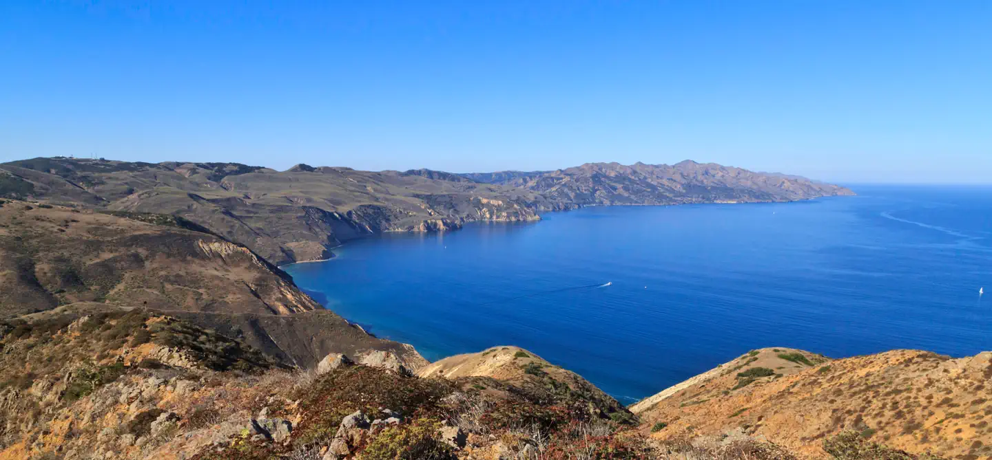
For a truly remote getaway full of backpacking and breathtaking scenery, take a backcountry trip to Santa Cruz Island's Del Norte Campground. Del Norte is currently the only backcountry campground on Santa Cruz Island. The National Park Service opened this backcountry site in recognition of its rare wilderness values. As you explore these wild areas, please take the responsibility to help us protect and preserve these delicate natural resources for future generations.
While backcountry camping is an incredible experience, it is not for the inexperienced backpacker. Due to difficult weather, rugged terrain, and off-trail hiking, backcountry camping is an arduous endeavor and should be undertaken only by experienced, well-conditioned backpackers.
To reach this backcountry site, visitors will backpack along a historic ranch road/trail through a series of canyons and ridges, to a vista about 700 feet above sea level. This moderate to strenuous 3.5-mile hike from Prisoners Harbor travels through island oak woodlands and coastal sage scrub plant communities.
Recreation
From Prisoners Harbor, the shortest route to the Del Norte Campground is 3.5 miles via the Del Norte Trail. Follow the Navy Road out of Prisoners Harbor for 1.5 miles (600-foot elevation gain; strenuous). This gravel road is still used daily by vehicles, so please use caution while hiking along it. During winter and spring, visitors need to be prepared for a wet creek crossing at Canada del Puerto in Prisoner's Harbor.
At the signed turn-off for Del Norte Trail, leave the gravel road and continue east (left) along the trail for 1.8 miles. The trail winds up and down two canyons (Cañada del Agua and Cañada del Muro)) to the signed junction with the Del Norte Road that leads .2 miles to the campground.
The longer route (5 miles), which provides views of the south side of the island, follows the Navy Road as it climbs 1,200 feet over 4 miles and eventually reaches the junction with the Del Norte Road. At the signed junction, turn north (left) and descend 1 mile to the campground.
From Scorpion Anchorage, Del Norte Campground is approximately 12 miles via the Navy Road.
Beach access is at Prisoners Harbor. There is no access to the beach at Del Norte Campground.
Recreational activities on Santa Cruz Island include hiking, swimming, snorkeling, diving, kayaking and wildlife/wildflower viewing. There are no services on the island, so all gear has to be brought to the island. Guided kayak trips and kayak rentals must be arranged before arriving on the island. For more information about recreational activities in the park, visit https://www.nps.gov/chis/planyourvisit/index.htm .Facilities
The Del Norte Campground has four primitive campsites (four persons per site) and users must camp within these designated sites. A picnic table and pit-style toilet are provided (campers must bring their own toilet paper). Visitors are encouraged to pack as light as possible (backpacking style) as they will need to carry all of their gear, food and water to the campsite. Water is not available. Access to the island is by Island Packers Cruises or by private boat.Natural Features
Del Norte is nestled in a shaded oak grove and provides scenic views of the island's pristine coastline.
The largest of California's Channel Islands, Santa Cruz Island is one of the five islands that make up the Channel Islands National Park. The island is rich in cultural history, magnificent landscapes, and unique flora and fauna. Native American Indians inhabited the island for over 10,000 years and Europeans explored and ranched on the island for over 150 years.
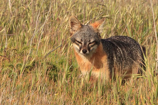
Over 600 plant species, 140 land birds, 11 land mammals and a handful of amphibians and reptiles call the island their home. The island fox and island scrub-jay are exciting finds, as they're unique to the island, found nowhere else in the world.
Show 4 more campgrounds
-
Santa Cruz Island Prisoners Harbor
Reservable Campground
The Prisoners Harbor Campground is located near the shoreline, and with a maximum capacity of 24 people, it offers a quieter experience than the larger campground at…
Reserve on Recreation.govDetails
Overview
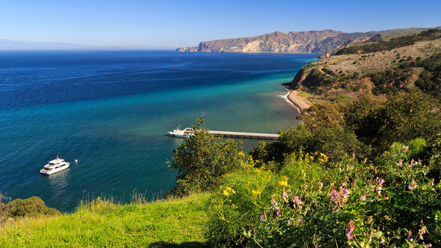
The Prisoners Harbor Campground is located near the shoreline, and with a maximum capacity of 24 people, it offers a quieter experience than the larger campground at Scorpion. The campground is a short hike from the pier and is sheltered from harsh ocean winds. As you explore this area, please respect the property boundary and help protect and preserve these delicate resources for future generations.
Santa Cruz Island, the largest of California’s Channel Islands, is one of the five islands that make up Channel Islands National Park. The island is rich in cultural history, magnificent landscapes, and unique flora and fauna. Native American peoples inhabited the island for over 10,000 years, and Europeans explored and ranched on the island for more than 150 years. More than 600 plant species, 140 land birds, 11 land mammals, and a variety of amphibians and reptiles call the island home. The island fox and island scrub‑jay are especially exciting finds, as they are unique to Santa Cruz Island and found nowhere else in the world.
Recreation
From Prisoners Harbor, the campground is only 0.3 miles from the pier. The road does follow a road which passes through a seasonal creek. While the campground has an accessible site and an accessible toilet, transportation to the campground requires use of a ladder and on an uneven road. This road is still used daily by vehicles, so please use caution while hiking along it. During winter and spring, visitors need to be prepared for a wet creek crossing at Canada del Puerto in Prisoner's Harbor. From Scorpion Anchorage, the campground is approximately 14 miles via the Navy Road. Beach access is at Prisoners Harbor. Recreational activities on Santa Cruz Island include hiking, swimming, snorkeling, diving, kayaking and wildlife/wildflower viewing. There are no services on the island, so all gear has to be brought to the island. For more information about recreational activities in the park, visit https://www.nps.gov/chis/planyourvisit/index.htm .
Facilities
The Prisoners Harbor Campground has six primitive campsites (four persons per site) and users must camp within these designated sites. Each site is 8 feet by 20 feet; smaller tents are appropriate for this location. A picnic table, food storage, and vault toilet are provided. Visitors are encouraged to pack as light as possible as they will need to carry all of their gear, food and water to the campsite. Water is not available. Access to the island is by Island Packers Cruises or by private boat.
Natural Features
The Prisoners Harbor Campground is nestled in a shaded oak grove.
The largest of California's Channel Islands, Santa Cruz Island is one of the five islands that make up the Channel Islands National Park. The island is rich in cultural history, magnificent landscapes, and unique flora and fauna. Native American Indians inhabited the island for over 10,000 years and Europeans explored and ranched on the island for over 150 years.
Over 600 plant species, 140 land birds, 11 land mammals and a handful of amphibians and reptiles call the island their home. The island fox and island scrub-jay are exciting finds, as they're unique to the island, found nowhere else in the world.
-
Santa Cruz Island Scorpion
Reservable Campground
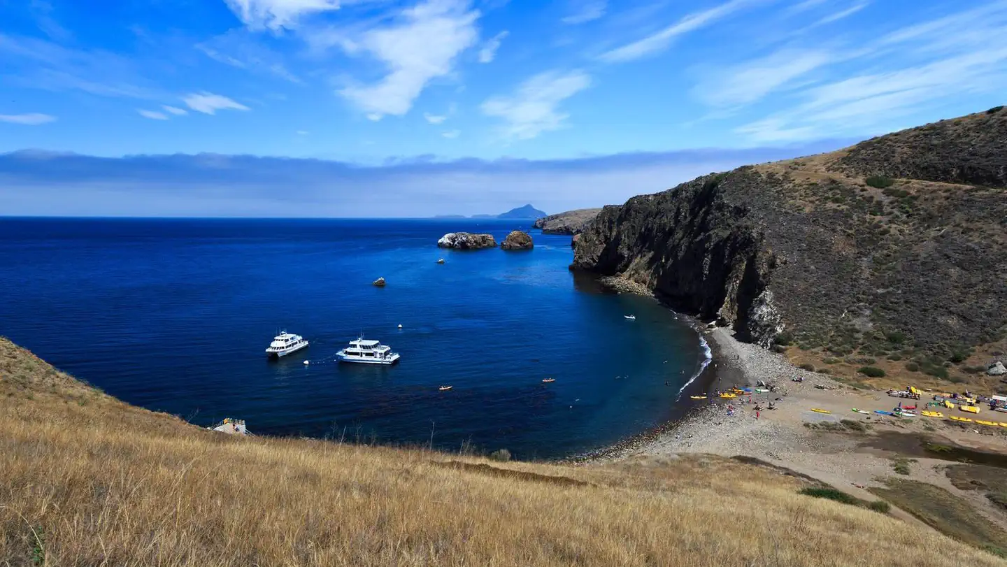
Fantastic ocean views and relaxing beach time is practically guaranteed at Scorpion Canyon Campground, the most family-friendly campsite on Santa Cruz Island. Set on the…
Reserve on Recreation.gov- Hiking
- Fishing
- Boating
- Swimming
Details
Overview
Fantastic ocean views and relaxing beach time is practically guaranteed at Scorpion Canyon Campground, the most family-friendly campsite on Santa Cruz Island. Set on the eastern part of the island, the campground is a short hike from the pier and is sheltered from harsh ocean winds. The largest of California's Channel Islands, Santa Cruz Island is one of the five islands that make up the Channel Islands National Park. The island is rich in cultural history, magnificent landscapes, and unique flora and fauna. Native American Indians inhabited the island for over 10,000 years and Europeans explored and ranched on the island for over 150 years. Over 600 plant species, 140 land birds, 11 land mammals and a handful of amphibians and reptiles call the island their home. The island fox and island scrub-jay are exciting finds, as they're unique to the island, found nowhere else in the world. For more information about Santa Cruz Island visit: https://www.nps.gov/chis/planyourvisit/santa-cruz-island.htm .Recreation
With its easy beach access and generally good weather, this area offers the most recreational activities in the park, including hiking, swimming, snorkeling, diving, kayaking and wildlife/wildflower viewing. There are no services on the island, so all gear has to be brought to the island. Guided kayak trips and kayak rentals must be arranged before arriving on the island. For more information about recreational activities in the park, visit https://www.nps.gov/chis/planyourvisit/index.htm.Facilities
Primitive camping is available at Scorpion Canyon Campground with 25 individual sites which accommodate up to six persons per site; and six group sites with up to 15 persons per site. Picnic table, food storage box, pit toilet, and water are provided. The campground is a flat 1/2 mile to 1 mile hike from the pier. Access to the island is by Island Packers Cruises or by private boat.Natural Features
The beach near the campground is a mix of sand and rocks, and faces the Santa Barbara Channel. The campground is located in a valley with a mixture of trees and shrubs. Rugged mountain peaks rise above the campground to 1,808 feet.Nearby Attractions
Hiking options are unlimited and offer spectacular coastal views. Try the 2 mile round-trip Cavern Point Loop hike for views of the island's mountain peaks, and the southern California coastline. This popular hike takes you past antique ranching equipment and historic buildings for a taste of island ranch history. For more advanced hikers, tackle the 7.5-mile round-trip hike from the campground to Smugglers Cove. -
Santa Rosa Island
Reservable Campground
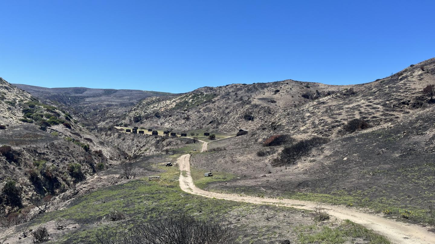
Tucked away in a canyon to protect visitors from strong northwest winds, Water Canyon Campground offers exceptional island views, access to spectacular hiking…
Reserve on Recreation.gov- Hiking
- Fishing
- Boating
- Swimming
Details
Overview
Tucked away in a canyon to protect visitors from strong northwest winds, Water Canyon Campground offers exceptional island views, access to spectacular hiking opportunities and a nearby white sand beach.
Located 40 nautical miles from the Channel Islands National Park visitor center in Ventura, Santa Rosa is the second largest island in California at approximately 53,000 acres in size. The island landforms support a diverse array of plant and animal species including six plant species found nowhere on earth but Santa Rosa Island. The island also hosts over 100 bird and three land mammal species, including the endemic island fox.
Recreation
Several trails and roads traverse the island, providing visitors with spectacular hiking opportunities, including the relatively flat route to Water Canyon Beach to the rugged, mountainous path to Black Mountain.
Due to the strong, persistent wind, swimming, snorkeling, diving and kayaking are limited and recommended for the experienced visitor only. Despite the wind, Santa Rosa Island offers exceptional beach walking on white sand beaches. Access to one of the best beaches, Water Canyon Beach, is just over a mile from the pier in Bechers Bay and just down canyon from the campground. Beach access is also available near the pier.
No fishing is allowed within the marine reserves located around the island. Fishing is allowed outside of these areas.
For more information about recreational activities in the park, visit https://www.nps.gov/chis/planyourvisit/index.htm.
Facilities
Primitive camping is available at Water Canyon Campground (15 sites; 5 persons per site). Picnic table, food storage box, windbreak (8' tall, 10' deep, 14' wide at front, 8' wide at back), restroom and water are provided. The campground is a flat 1.5-mile hike from the pier and a 0.25-mile from the airstrip and Water Canyon Beach. Due to the boat schedule, minimum stay is generally three days.
Natural Features
Santa Rosa has a landscape of remarkable contrasts. High mountains with deeply cut canyons give way to gently rolling grass-covered hills, extensive beaches and coastal wetlands. The altitude ranges from sea level to 1,589 feet.Nearby Attractions
Good tidepooling spots are located within Bechers Bay, including just east of the pier, the east end of Southeast Anchorage, and near East Point.
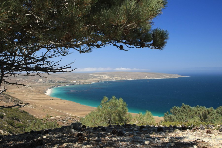
A short hike from the campground is the Santa Rosa Island Torrey pine grove. This pine is considered one of the rarest pines in the world-the last enduring members of a once widespread Pleistocene forest. Near the pier, visitors can see buildings and equipment of the historic Vail and Vickers ranch.
Access to a highly recommended beach, Water Canyon Beach, is just over a mile from the Bechers Bay pier. The sandy beach lies on the northeastern shore of the island. Bechers Bay is a destination in itself, with buildings and equipment at the historic Vail and Vickers ranch.
-
Santa Rosa Island Backcountry Beach Camping
Reservable Campground
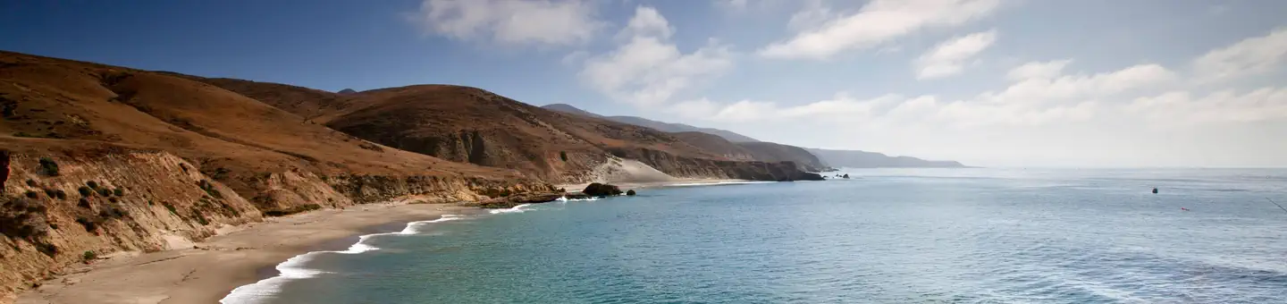
Backcountry beach camping is available mid-August through December along Santa Rosa Island's extensive, beautiful, and undeveloped 55-mile coastline. This coastline is…
Reserve on Recreation.gov- Hiking
- Fishing
- Boating
- Swimming
Details
Overview
Backcountry beach camping is available mid-August through December along Santa Rosa Island's extensive, beautiful, and undeveloped 55-mile coastline. This coastline is reminiscent of California in days gone by. The rocky coast and sandy beaches are much the same as the ones the Chumash Indians, Spanish explorers, and early ranchers may have known. This remote, fragile environment is critical for sea and shorebirds, marine mammals, and plant communities.
In 1992, the National Park Service opened the island to backcountry beach camping in recognition of its rare wilderness values. As you explore these wild areas by kayak or on foot, please take responsibility to help us protect and preserve these delicate natural resources for future generations. The following information will help you enjoy your visit while leaving the smallest impact on the island.
Warning: While backcountry camping is an incredible experience, it is not for the inexperienced backpacker or kayaker. Due to difficult weather, rugged terrain, and off-trail hiking, backcountry camping is an arduous endeavor and should be undertaken only by experienced, well-conditioned backpackers and kayakers. Less experienced visitors to the island should consider frontcountry camping at Santa Rosa Island Campground in Water Canyon, which also offers advance reservations with some amenities (e.g., pit toilet, picnic table, water).
WAG Bags Required: Visitors are required to pack out human waste and toilet paper in the backcountry using "WAG" (human waste collection) bags. Visitors must bring there own bags which are available from outdoor suppliers.
Backcountry Beach Camping Dates
- January 1 - August 14: Backcountry beach camping is CLOSED to protect pupping seals/sea lions and nesting seabirds.
- August 15 - September 15: Only East Point to South Point Beaches (Southeast Quadrant) are open to backcountry camping for boaters, kayakers, and backpackers.
- September 16 - December 31: Southeast, Southwest, and Northwest Quadrant beaches are open to backcountry camping. Beaches around Sandy Point, at Lobo Canyon, and Northeast Quadrant beaches (between Carrington Point and East Point) remain closed to camping.
Recreation
Boat and Airplane Drop Off Points.
The park boat concessionaire, Island Packers, drops off and picks up kayakers and backpackers at the Bechers Bay pier. Campers should coordinate purchasing boat tickets in conjunction with making campground reservations.
There is currently no park airline concessionaire, private landings on the airstrip near Water Canyon, or anywhere else on the island, is prohibited.
Trail Conditions.
Hiking to beach camping areas requires travel along rugged exposed mountainous roads, trails, and unmaintained routes often created by island animals. Expect high winds and sunny conditions with no shade or cover. Navigating beaches and bluffs may be possible depending on ocean conditions and commonly require hiking across drainages and badlands. It is recommended to carry tide charts when navigating the beaches, coasts and bluffs. Some road/trail intersections have signs, some do not. Most trails and routes do not get you directly to a beach camping area, but instead end above a marine terrace/bluff or on top of a canyon and you must find the safest way down to the beach.
Maps.
Please refer to topographical maps for more accurate mileage and to help with the following descriptions. It is recommended that all backcountry campers have both digital and physical maps. Backpackers should carry topographic maps (USGS 7.5 minute maps or the Trails Illustrated map of all the islands) and kayakers carry nautical charts before departing on their journey.
Hiking and Kayaking Distances to Beach Camping Areas.
Backcountry campers should be prepared to hike 10+ miles (16 km+) on their first and last days in the backcountry regardless of itinerary. While some beaches are less than 10 miles away, you may arrive to find your destination beach unavailable (occupied by other campers, covered in pinnipeds, under water from high tides, etc.) and need to hike to the next available beach.
Southeast Quadrant (August 15-December 31)
East Point from Pier: 7 mi (11 km) hiking; 8 mi (13 km) kayaking*
East Point to Ford Point: 8 mi (13 km) hiking; 5 mi (8 km) kayaking**
Ford Point via South (Wreck) Road from Pier: 9 mi (14.5 km) hiking+
Ford Point to Johnsons Lee: 4 mi (6.5 km) hiking; 3.5 (6 km) kayaking+
Johnsons Lee (via East Point) from Pier: 18 mi (29 km) hiking; 16 mi (26 km) kayaking**
Johnsons Lee via Main (Soledad) Road from Pier: 14 mi (22.5 km) hiking+
Johnsons Lee via South (Wreck) Road from Pier: 13.5 mi (22 km) hiking+
La Jolla Vieja via South (Wreck) Road from Pier: 11.2 mi (18 km) hiking+
* Camping Just South of East Point is NOT Recommended. While no camping is allowed at East Point, there is a small pocket beach just to the south in the Southeast Quadrant. However, it is not recommended for camping as this beach is very, small and may be washed out at higher tides. In addition, pounding surf and strong winds constantly reshape this beach.
** Hiking Beyond East Point. If hiking beyond East Point to Ford Point, it is recommended that you follow the ridge line or road until you reach the northeast ridge of San Augustine Canyon. Follow this ridge down to the mouth of the canyon. Hiking along the beach from East Point to Ford Point is impossible due to section of vertical cliffs that drop directly into the ocean. However, kayakers can access beaches throughout this area. Once hikers reach Ford Point, they may follow the low terrace or higher ridge (both eventually run into a coastal road) down to the Johnsons Lee area. Refer to topographical maps for more information.
+ Direct access to beaches between Johnsons Lee and Ford Point (including La Jolla Vieja) is also possible via the Main (Soledad) or South (Wreck) roads. Both of these routes are long hikes and with a considerable amount of climbing and, once again, like all hiking or kayaking on the island, is recommended only for the experienced, well-conditioned traveler.
Southwest Quadrant (September 16-December 31)
Backcountry camping in the Southwest quadrant is extremely difficult and only recommended for experienced backpackers due to long distances, frequent high winds, and lack of reliable water sources. Be aware of closures and requirements to stay on routes in this area. There is no camping or beach access between China Camp and Cluster point OR around Sandy Point.
Trancion Canyon: 14 mi (22.5 km) hiking; 20 mi (32 km) kayaking++
Northwest Quadrant (September 16-December 31)
Backcountry camping in the Northwest quadrant is extremely difficult and only recommended for experienced backpackers due to long distances, frequent high winds, washed-out beaches at high tides, and lack of reliable water sources. Be aware of closures and requirements to stay on routes in this area. There is no camping between Carrington Point and Lobo Canyon.
Dry Canyon: 10 mi (16 km) hiking; 11 mi (17.7 km) kayaking++
Arlington Canyon: 12 mi (19.3 km) hiking; 12.5 mi (20 km) kayaking++
++Beginning September 16, the closest beach camping is Cow Canyon. However, this beach can wash out at high tide and/or large swell and is NOT recommended. Nearby Lobo Canyon beach is closed to beach camping and only available for day use. Therefore, Dry Canyon is the closest beach in the Northwest Quadrant that is recommended for camping.
Facilities
No facilities
This is primitive, dispersed, backcountry camping in tents with no established campsites nor electricity/water/sewer site hook-ups. Visitors must backpack to all locations and carry all of their own gear, food and water (see water information below).
Pack Out What You Pack In
Visitors are required to pack out what they pack in, including garbage and human waste. It is prohibited by law and regulation to leave human solid waste in the backcountry or in the wet intertidal sand. Human waste and toilet paper must be packed out for proper disposal using commercially available "waste bags".
Camp Only On Beaches
Visitors are required to camp on beaches. Camping is prohibited in any other areas, including coastal bluffs. Utilize sandy areas that are free of dune vegetation when hiking, landing water craft, and camping. Keep tents, kitchen areas, and traffic in "hardened" areas that are already bare from previous use. Do not damage live trees, plants, and other living things. It is not permitted to chop or nail trees, harvest or trample plants.
Water & Water Treatment
One gallon of water per person per day is recommended. Water weighs approximately 8 pounds per gallon. Potable water is available in the Water Canyon campground. During the backcountry camping season (mid-August through December), the only location outside the Water Canyon campground with an accessible, reliable water source is the Clapp Spring trough, approximately 7 miles from the pier [.6 miles south-southeast on Sierra Pablo Road from the intersection with South (Wreck) Road; 33°56’50” North, 120°03’19” West]. The water at Clapp Spring is safe to drink when boiled, filtered, or treated with iodine.
Although ten canyons may carry some degree of water intermittently throughout the year (except during dry years), water is not always available. Water found at the mouth of the canyons near beaches is likely to be brackish or dirty, walking up canyon for 5-10 minutes generally improves water quality. These ten canyons include: Water, Trancion, Bee, San Augustine, Wreck, Jolla Vieja, Arlington, Soledad, Cow, and Lobo. Water may be found in streams or stagnant pools, it can be thick with sediment and/or contaminated with coliform bacteria and giardia. Using a physical filter is recommended in addition to treating by boiling and/or using purification methods such as iodine.
Important Closures:
Year-round. Backcountry beach camping is prohibited between Lobo Canyon and East Point, between China Camp and Cluster Point, and all beaches around Sandy Point.
January 1 - August 14. All beaches are closed to backcountry beach camping to protect pupping seals/sealions and nesting seabirds.
August 15 - September 15. Northwest and northeast beaches are closed to camping. Only the Southeast Quadrant (East Point to South Point Beaches) is open to backcountry camping. From September 16 through December 31, all Southeast, Southwest, and Northwest Quadrant beaches are open to backcountry camping.
March 1 to September 15. Back beaches and sand dunes between and including Skunk Point to just north of East Point are closed to hiking to protect the nesting area for the snowy plover, a federally listed, threatened shorebird. Please remain on the wet sand (below mean high tide) or the throughout this area.
Additional Information
Please visit Backcountry Beach Camping: Santa Rosa Island on the Channel Islands National Park website for more information.
Natural Features
Weather
Weather conditions are generally best from August through October, with relatively calm wind and sea conditions and virtually no rain. Backpackers and kayakers should be prepared for strong northwest winds throughout the year, with the possibility of strong east or Santa Ana winds from October through January. The average wind speed is 15 knots, although speeds of 40 to 50 knots are not uncommon. Occasionally, the south side of the island (South Point to East Point) offers protection from these strong winds. Dense fog is common making chart and compass navigation mandatory. For the most current weather forecast, please visit Channel Islands National Marine Sanctuary's Internet Weather Kiosk .Ocean Conditions
Kayakers may encounter strong ocean currents around the islands. Intense wave and surf conditions exist around the Carrington Point area. Sheer cliffs rise out of the ocean, reflecting incoming waves back out to sea, creating a washing machine effect. In this turbulent area there are no places to land, even in an emergency. The first landable beach is Lobo Canyon, five miles west of the ranch area pier. Rounding Skunk Point may be tricky as well because of merging currents. The wind often increases in the afternoon, and the prevailing northwesterlies can make paddling back to Water Canyon difficult. During the summer months, large swells often pound the south side of the island, making landing and launching from the beaches extremely challenging, requiring advanced skills. Ocean water temperatures range from the lower 50s (F) in the winter to the upper 60s (F) in the fall.
Facilities & Services
Find visitor centers and other services available in the park. Check current hours and availability before you go.
Visitor Centers
-
San Miguel Island Ranger and Visitor Contact Station
Visitor Center
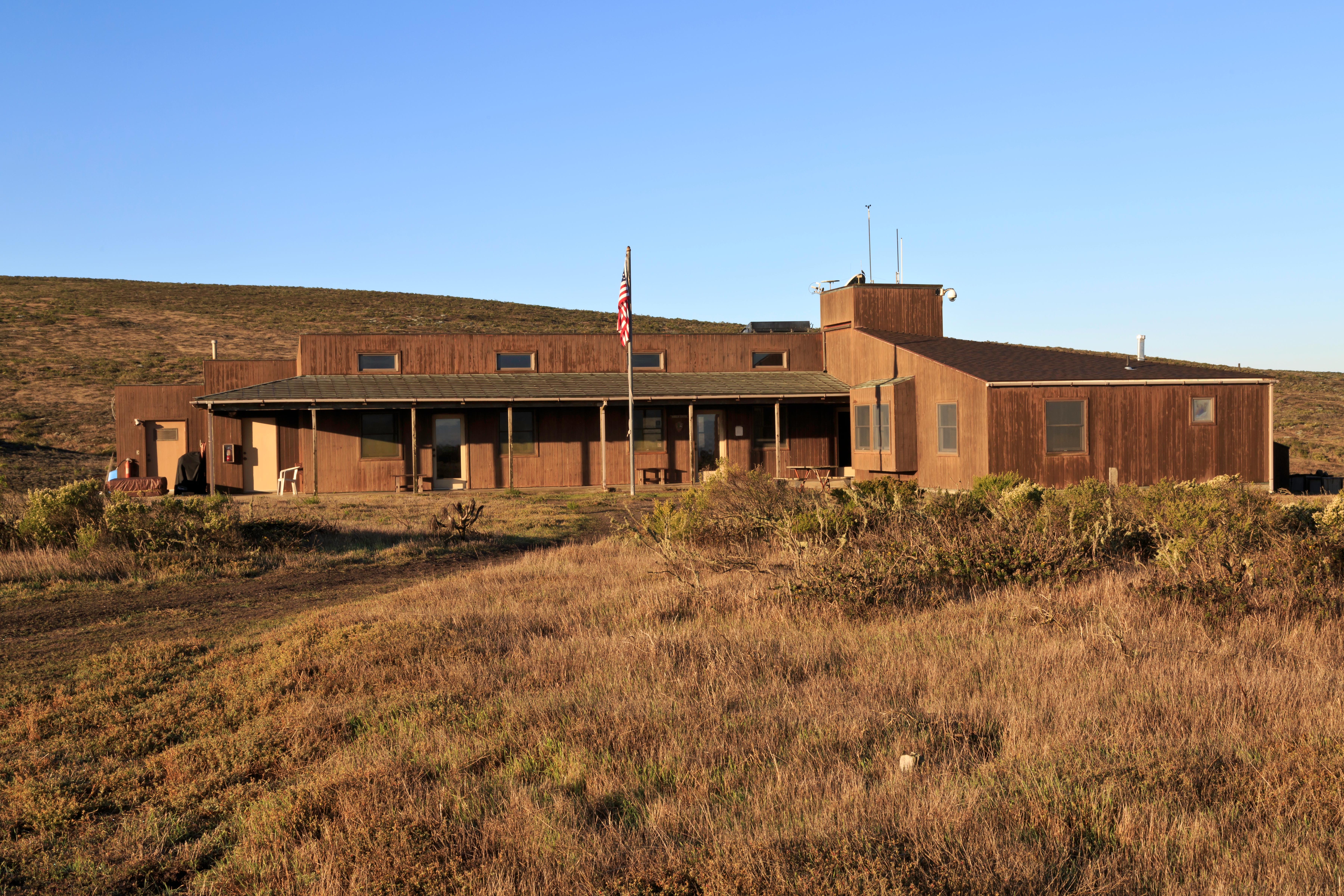
The visitor contact and ranger station is only open when staff is present.
San Miguel Island Visitor Contact and Ranger Station, Ventura, CA (805) 658-5730 Directions
Details
The visitor contact and ranger station is only open when staff is present. -
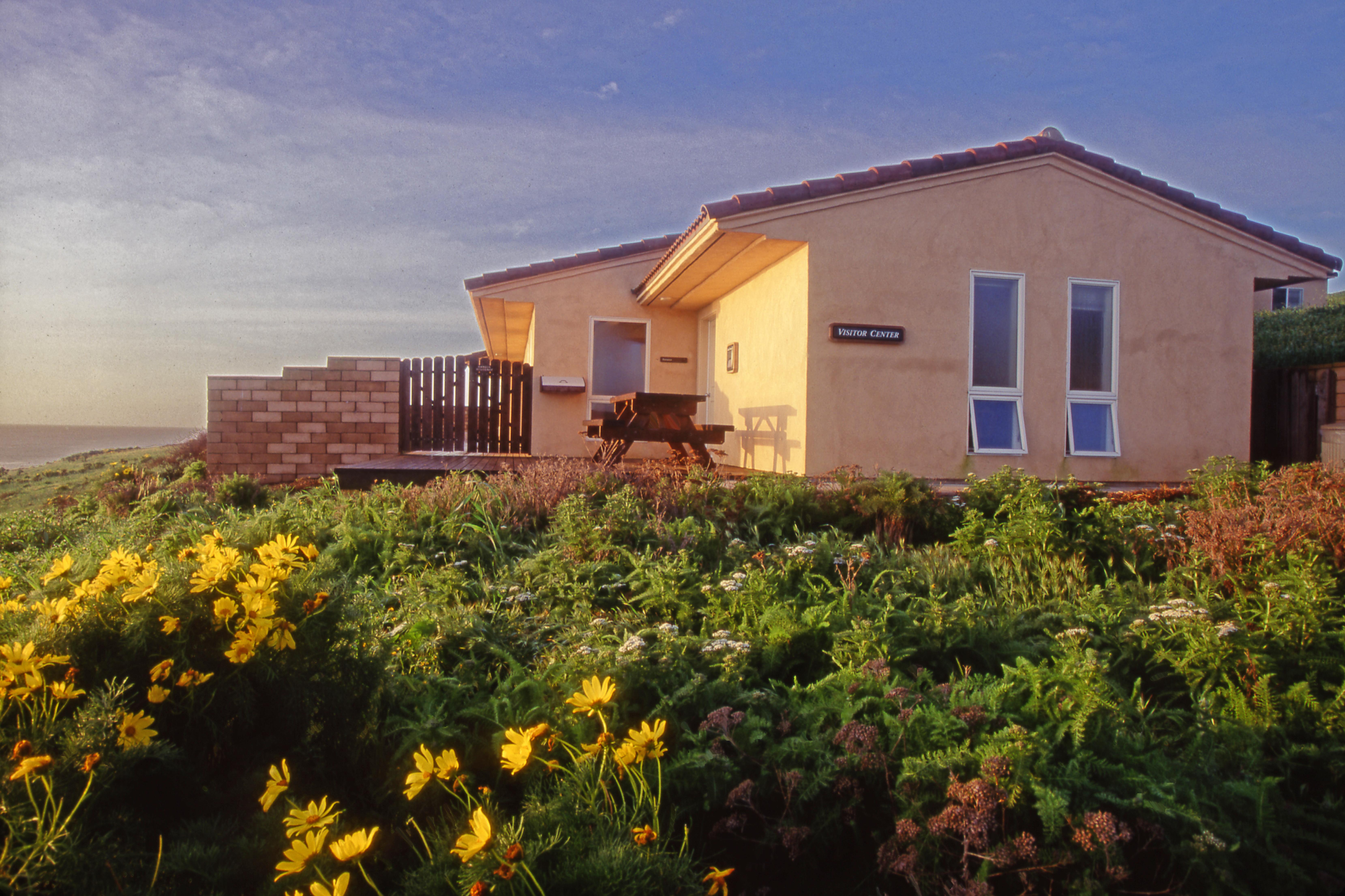
Santa Barbara Island Visitor Center
Visitor Center
A small visitor center is located on the island. Features include displays on the natural and cultural resources of the island.
Details
A small visitor center is located on the island. Features include displays on the natural and cultural resources of the island. -
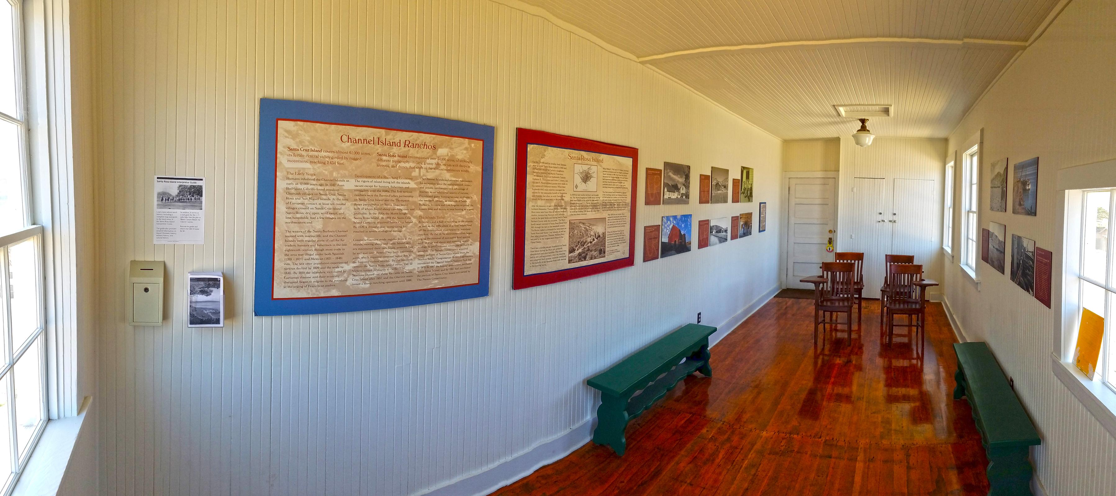
Santa Rosa Island Visitor Contact Station
Visitor Center
The historic schoolhouse is now home to this small visitor contact station with exhibits on the ranching history of Santa Rosa Island.
Details
The historic schoolhouse is now home to this small visitor contact station with exhibits on the ranching history of Santa Rosa Island. -
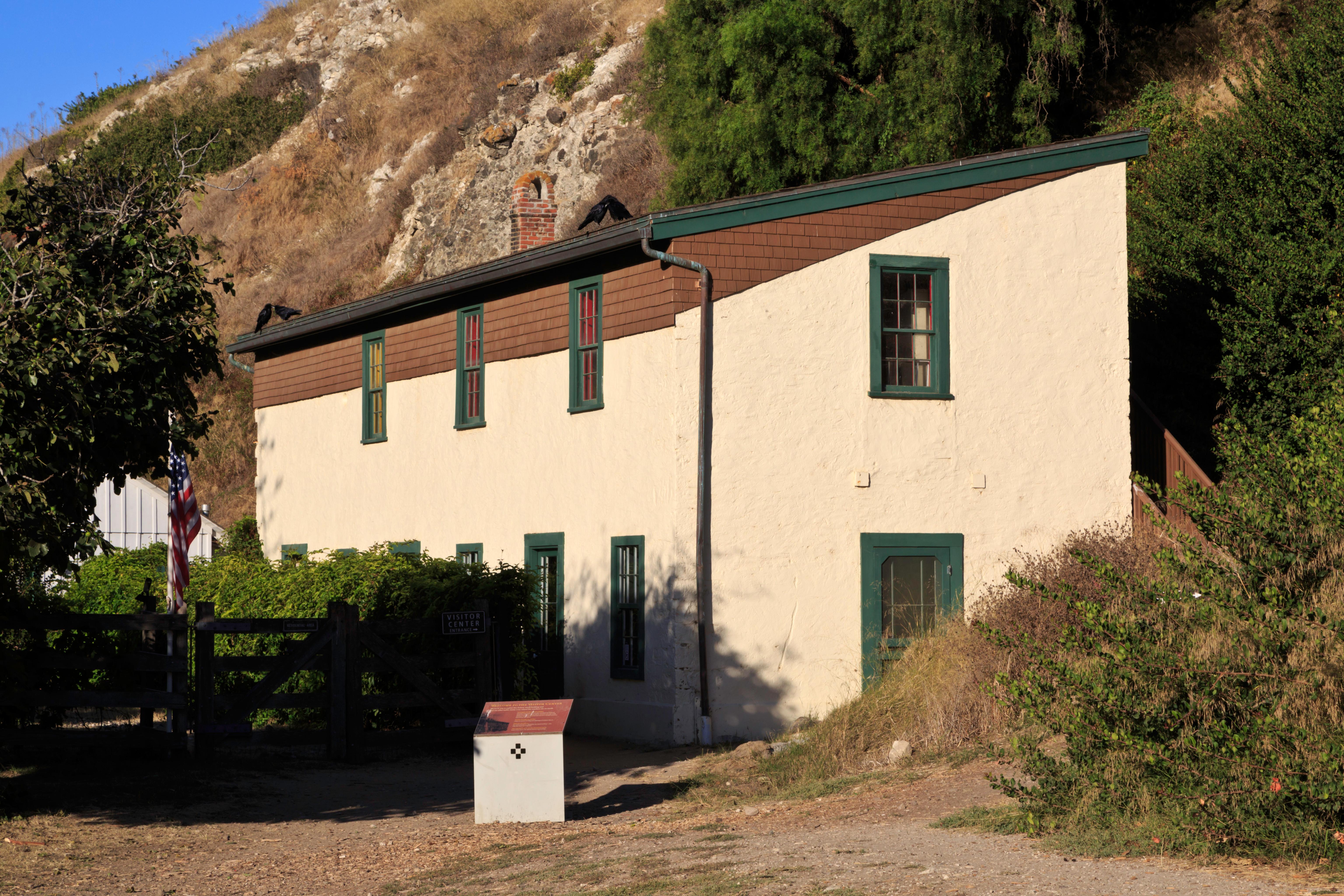
Scorpion Ranch Visitor Center on Santa Cruz Island
Visitor Center
The small visitor center resides in the historic Scorpion Ranch house which was constructed in 1886-1887.
Scorpion Ranch Visitor Center on Santa Cruz Island, Ventura, CA (805) 658-5730 Directions
Details
The small visitor center resides in the historic Scorpion Ranch house which was constructed in 1886-1887.
Other Visitor Services
-
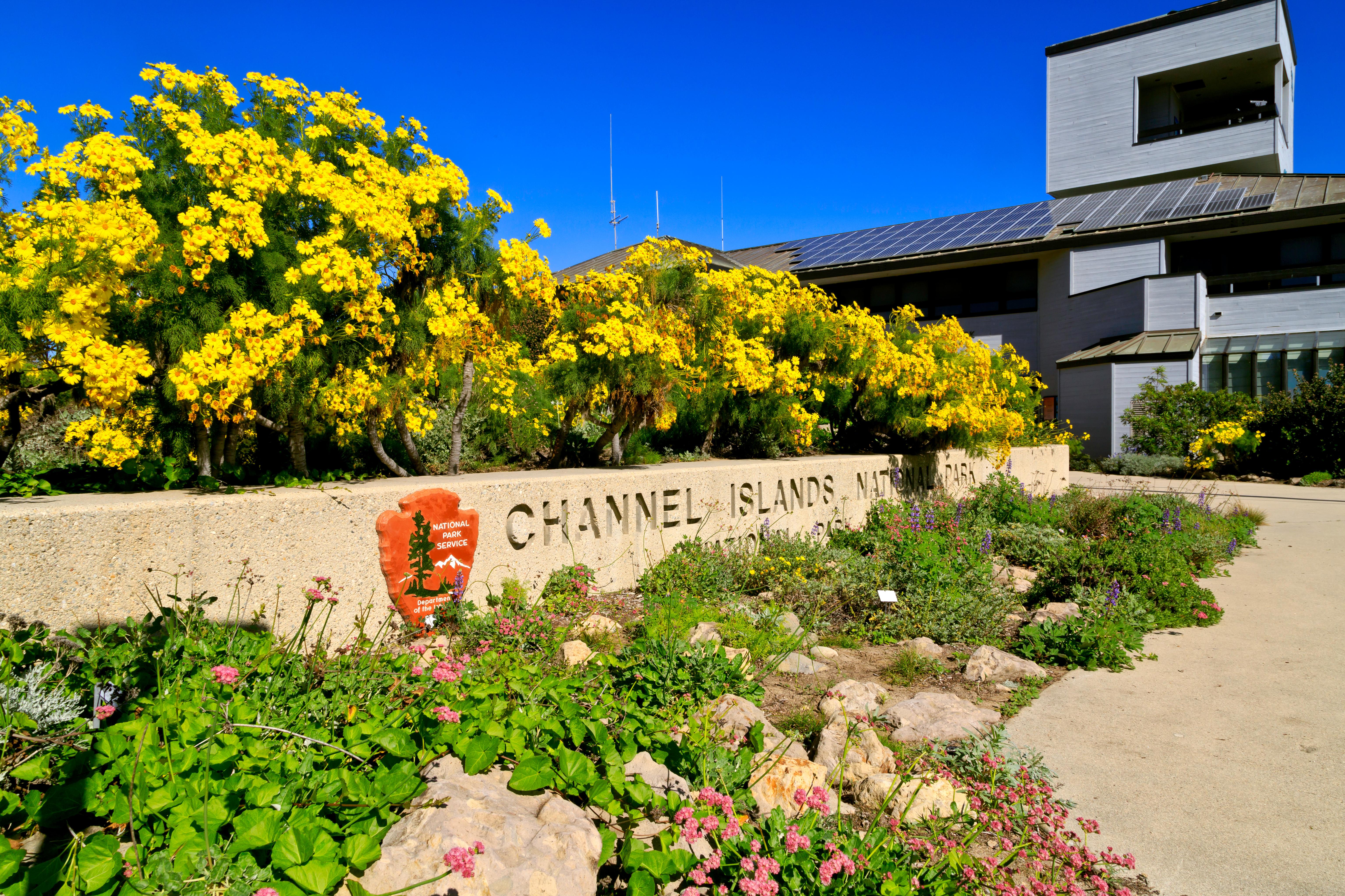
Channel Islands National Park Visitor Center
Facility
The Robert J. Lagomarsino Visitor Center at Channel Islands National Park features a bookstore, a display of marine aquatic life, and exhibits featuring the unique…
1901 Spinnaker Drive, Ventura, CA (805) 658-5730 Directions
Details
The Robert J. Lagomarsino Visitor Center at Channel Islands National Park features a bookstore, a display of marine aquatic life, and exhibits featuring the unique character of each park island. Visitors also will enjoy the 25-minute park movie, “A Treasure in the Sea,” shown throughout the day in the auditorium (closed-caption film available upon request). The fully accessible visitor center is open 8:30 am until 5 pm daily. The visitor center is closed on Thanksgiving and December 25th. -
Outdoors Santa Barbara Visitor Center
Facility
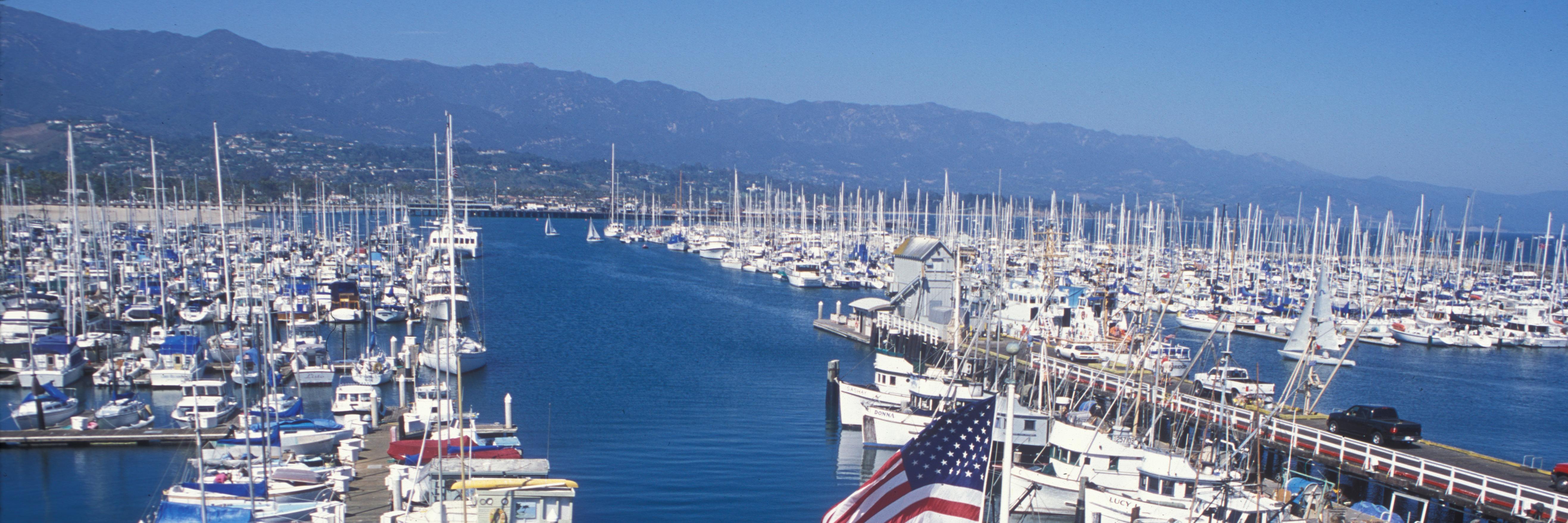
The small Outdoors Santa Barbara Visitor Center not only has one of the best views of Santa Barbara, but also offers visitors information about Channel Islands National…
113 Harbor Way 4th Floor, Santa Barbara, CA (805) 884-1475 Directions
Details
The small Outdoors Santa Barbara Visitor Center not only has one of the best views of Santa Barbara, but also offers visitors information about Channel Islands National Park, Channel Islands National Marine Sanctuary, Santa Barbara Maritime Museum, and the City of Santa Barbara. Open 10:30 am until 4:30 pm daily. The visitor center is closed on Thanksgiving Day, December 25, January 1, and the first Friday in August for Fiesta.
Show 1 more facility
Visitor Centers
-
Visitor Center Anacapa Island
Visitor Center
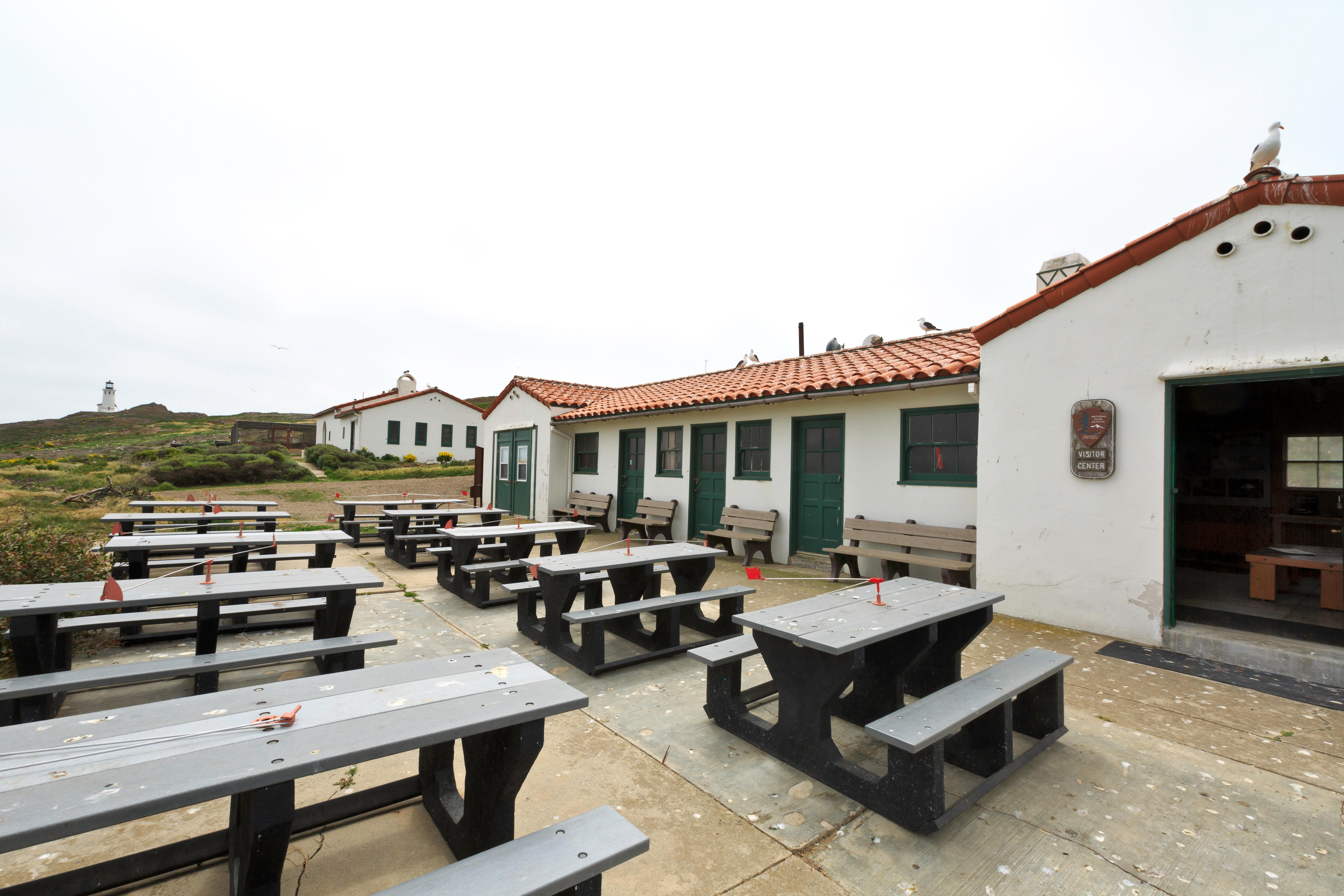
Once the historic Coast Guard general services building (workshop and garage), this Mission Revival style building now serves as a small visitor center that features…
Anacapa Island Visitor Center, Ventura, CA (805) 658-5730 Directions
Details
Once the historic Coast Guard general services building (workshop and garage), this Mission Revival style building now serves as a small visitor center that features include displays on the natural and cultural resources of the island and the original lead-crystal Fresnel lens from the Anacapa Lighthouse.
Plan Your Visit
Hours
Open 24 hours, daily · Channel Islands National Park
Hours details
-
Channel Islands National ParkOpen 24 hours, daily
The park is open 24 hours a day. Services and facilities have separate hours. Please see descriptions of those facilities elsewhere.
Entrance fees
No entrance fees listed.
Address
1901 Spinnaker DriveVentura, CA 93001
Contact the park
Weather & conditions
64°F
Patchy rain nearby · feels like 60°
-
Today
68° 46°
Patchy rain nearby36% rain
-
Tomorrow
 73° 44°
Sunny1% rain
73° 44°
Sunny1% rain -
Wednesday
82° 51°
Sunny0% rain
Updated 5 hr ago
What to expect by season
In general, the islands have a Mediterranean climate year-round. Temperatures are relatively stable, with highs averaging in the mid-60s (°F) and lows in the low-50s. However, there are seasonal differences that visitors should take into consideration when visiting the park. In addition, visitors also should be aware that ocean and weather conditions vary considerably from day-to-day and island-to-island. For more information visit: http://www.nps.gov/chis/planyourvisit/weather.htm
Upcoming Events
2 coming up-
Guided Hikes on the Islands
About
On days that the concessionaire boats run to the islands, guided hikes may be offered by national park rangers, volunteers, or concessionaire naturalists. If they are not available to lead hikes, self-guided interpretive trail booklets are available.
Guided hike locations, distances, and departure times will be announced after your arrival on the island during the visitor orientation.
Please check with a ranger, volunteer, or concessionaire employee for more information.
-
Native Plant Sale
About
Find native plants to transform your garden, patio, or windowsill. California and the Channel Islands are blessed with a variety of beautiful, easy to care for plants. They provide essential habitat for neighborhood wildlife. Donations during the sale support the park through its philanthropic partner, Channel Islands National Park Foundation.
Photos
-
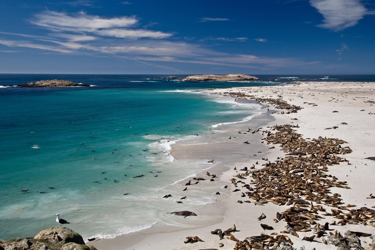
Point Bennet, San Miguel Island: One of the greatest concentrations of wildlife in the world occurs on San Miguel with over 100,000 pinnipeds gathering to breed, pup, and rest. — Tim Hauf, timhaufphotography.com -
Getting There
Ventura, CA 93001
While the mainland visitor center in Ventura is readily accessible by car or public transportation, the islands are only accessible by park concessionaire boats and planes or private boat. Advanced planning is highly recommended.
Mailing address: Superintendent, Ventura, CA 93001
Map loads when you scroll here